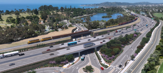
This week on the podcast, we're joined by Mary Pat McGuire, associate professor of landscape architecture at the University of Illinois. McGuire talks with us about what happens to water after it hits the pavement, the damaging environmental effects of covering cities in pavement, and steps we can take to reduce runoff in green cities.
For those of you who get your news through your eyes and not your ears, there’s an edited transcript below the audio player. If you want a full unedited transcript (with some typos!), click here. If you want to listen, here you go:
Jeff Wood: I’m thinking about how hard it is for us to kind of include this type of thinking into what we’re generally doing in terms of constructing roads and thinking about pavement generally. Because when we kind of repair a road or we build a new road or we think about a new transit line or those types of things, a lot of times the engineers will look at that specific engineering process of building that line. But there’s all these other things that need to happen for it to be sustainable in one way or another.
So including green infrastructure and some people will add a little thing here and a little thing there, but it’s actually the whole process that needs to be amended. I’m curious how that’s done, if we can actually do that in from an engineering context. I mean, not just from landscape architecture, but from thinking about transportation models and thinking about building roads and transit lines and those types of things, like how do we incorporate the systems thinking that allows us to be more sustainable.
Mary Pat McGuire: You said it so well, and I’m glad you brought up Philadelphia. They’re a great city for explaining that they did have a fork in the road where they were evaluating the trade-offs between green and gray infrastructure investment. They, like Chicago, were under consent decree from the EPA to make a decision about how to improve the quality of their waterways and the problems of combined sewer overflow, et cetera. I think that, at a core level, Philadelphia was also more advanced than a city like Chicago and already looking at the presence of vacant land. They were trying to look at for a number of years, how they could take some of the changes across the city and make those opportunities.
So how to think about vacant land is as more productive land. For example, I think at a gut level, they were also questioning the production of just more underground tunnels. So they said, well, they’re thinking like, well, great green infrastructure, as many other benefits for the city. So they did a full study to evaluate how they could capture that runoff through the land instead, throughout the city, rather than thinking about building an underground tunnel, that would really be multifunctional. It would do one thing and not benefit anything else. So they undertook that study and then they made a commitment, and they signed the consent decree with EPA to go green instead of gray. That is complicated. These things are hard to roll out, but what that results in is a series of planning and policies around a systems way of thinking about the continued development and urbanization of the City of Philadelphia.
It means that, in every way, you look at every opportunity to capture storm water through the city, through the fabric of the city. So the street, rights of way, as you said: If you’re going to be reconstructing a street, you should be thinking about how to retrofit the street to capture stormwater. We know how to do it. There are many, many design manuals out there to do complete and green streets. We understand how to re-engineer surface paving. We know how to collect water underground through stone reservoirs. We know how to create continuous soil volume for growing trees and other absorptive plants. We know how to re-engineer the section of the street to absorb stormwater, et cetera.
So that’s a perfect example of where it’s about change management at a city level. It’s about all of the different agencies that are involved with advancing the cities through 21st century design, to think about coordinating in reconstructing our cities for climate change. It’s about all of our disciplines starting to work together to think about building design, urban design, landscape architecture, and the planning of both reconstructing neighborhoods. I’ll mention that new developments sometimes are better at these things, because you can start at the beginning and you could integrate natural systems design into an urban development. But what we’re confronted with now and the things that I’m just fascinated with are: how do we retrofit?
How do we come back in and do the thing you’re asking? How do we retrofit and reconstruct existing conditions or existing situations? That’s a bit trickier, one because it requires a different kind of coordination where we have to find those spaces in the landscape. When I say landscape, I don’t mean the garden or the park over there. I think of everything as a constructed landscape. We have to find those opportunities, and you’re right. It can’t just be a small little thing over there, a small bio swale, or just like take out a couple of parking spaces. You know, we really do have to think at bigger and bigger scales about how to retrofit the ground, and at every new project opportunity to integrate more absorptive surfaces and to re-engineer the section of ground.
So can no longer be one solid, impervious surface that is basically negating any potential infiltration. That’s just a kind of like heat bounce, and also quite unpleasant to interact with visually and through our bodies. [We need] to start thinking about the ground as a more dynamic surface. I’ve done some research with some geologists and engineers here at the University of Illinois to evaluate how much land we need to retrofit. If it were me, I would say, well, all of it, but I’m also a realist. I have worked with them to understand the role of soils, subsoils that once depaved, once retrofitting a street or a parking lot, or some kind of other urbanized surface, how much do we need to retrofit and do we need to know about the soils, those native or sub soil conditions there? We need to understand how water would flow to those new openings in the ground, and what should be not just the percentage of surface disruption or surface redesign, but what would be the distribution of that?
How much of a parking lot, or how much of a whole neighborhood, should we be thinking about depaving and then resurfacing or bringing to life? It’s incredibly entangled question. Also one that is only can only be answered specifically city by city and neighborhood by neighborhood. Each condition is going to vary.
