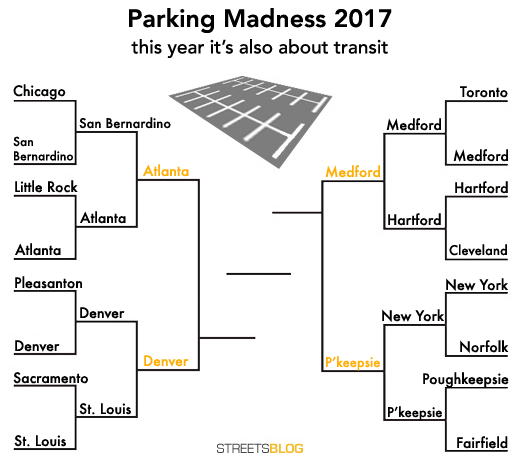
Parking Madness Final Four: Atlanta vs. Denver
We’ve whittled a field of 16 parking craters next to transit stations down to the Final Four in Parking Madness 2017.
The winner of today’s match will go up against whoever emerges from the contest between Medford and Poughkeepsie, which are still duking it out (you can vote until 2 p.m. Thursday).
This semi-final pits central areas in two major American cities against each other. Only one will have a shot at everlasting shame in the championship match.
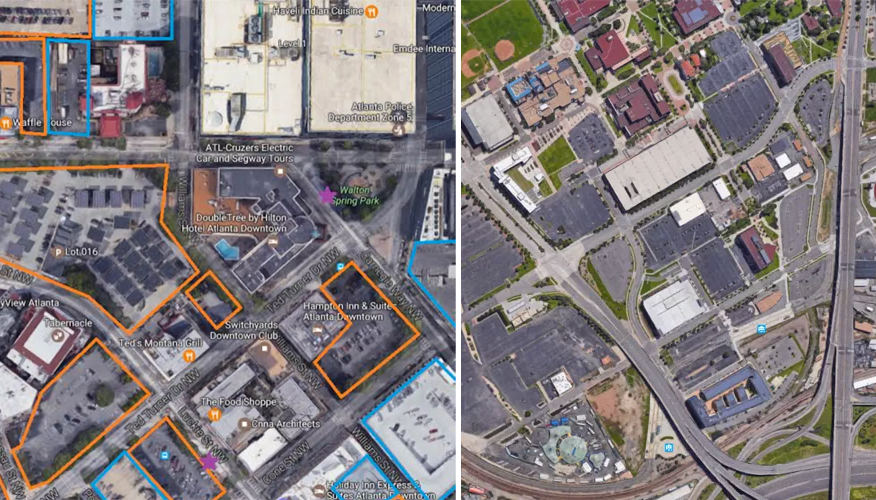
Atlanta — Luckie Street and Centennial Olympic Park Drive
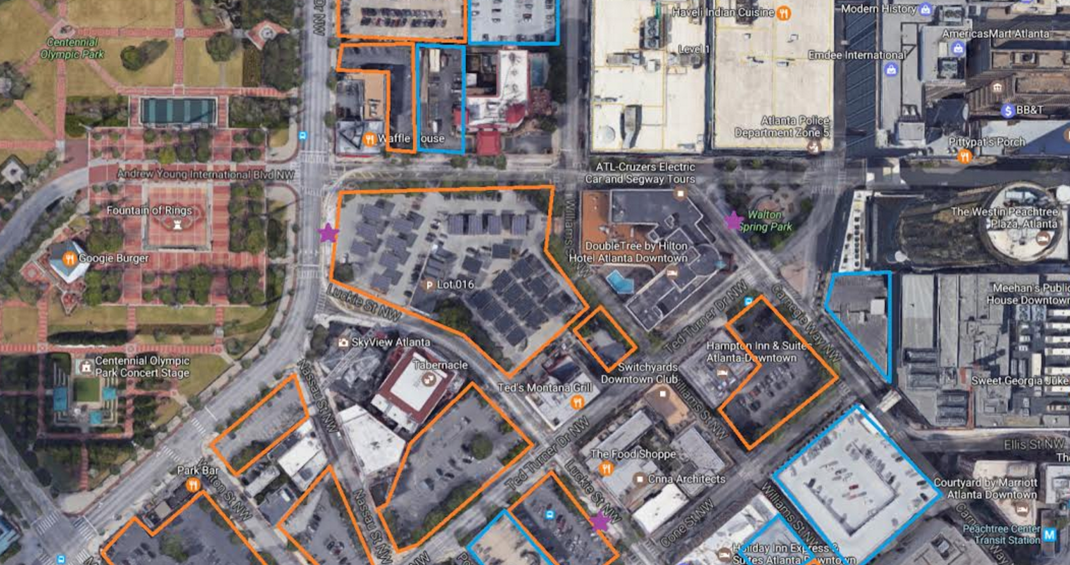
Reader Michelle Rushing sent us this view of the parking around three Atlanta streetcar stops (the purple stars). Surface parking is outlined in orange, and parking garages are outlined in blue. This entry beat craters in San Bernardino and Little Rock in earlier rounds of competition.
Not surprisingly, a short, mixed-traffic streetcar winding between so many parking lots is not getting much use. The line only attracts about 700 riders a day.
Rushing says of this site:
There is a park on one side but the surrounding blocks are parking and more parking, punctuated by an occasional restaurant or hotel. In the 2+ years since the streetcar was completed, the only development has been to add solar panels to the parking lot next to the stop.
Denver — Pepsi Center/Mile High Stadium/West Auraria
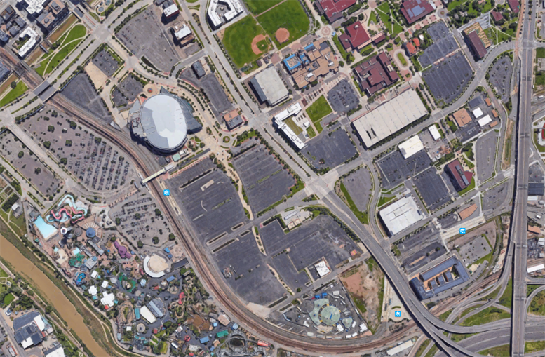
There are three light rail stops within this Denver parking crater, which beat out a BART station and a suburban St. Louis light rail stop to reach the Final Four. Parking for an amusement park, the Pepsi Center (where the Nuggets play) and Mile High Stadium (where the Broncos play, below the frame), swamps this part of the Auraria neighborhood near Metropolitan State University of Denver.
Reader Jerry Goudin, an alum MSU of Denver, provides some background on how Auraria got to be this way:
In 1965, the S. Platte River, which can be seen in the lower left corner of the image, overran its banks and large portions of areas near the river flooded including the rail yards. The rail yards ran next to the river for much of its length in downtown Denver. The area in the upper right portion of the image was the neighborhood of Auraria and is now the Auraria campus. For the most part, Auraria was spared from the flood but the city of Denver used the flood as a pretext to consolidate three growing academic institutions in one place and, by doing so, wipe out much of the Auraria neighborhood. Here is a [photo] that shows the Auraria neighborhood before the establishment of the campus.
Cast your vote to determine which of these asphalt oceans will contend for the Golden Crater in the Parking Madness final.

Read More:
Streetsblog has migrated to a new comment system. New commenters can register directly in the comments section of any article. Returning commenters: your previous comments and display name have been preserved, but you'll need to reclaim your account by clicking "Forgot your password?" on the sign-in form, entering your email, and following the verification link to set a new password — this is required because passwords could not be carried over during the migration. For questions, contact tips@streetsblog.org.