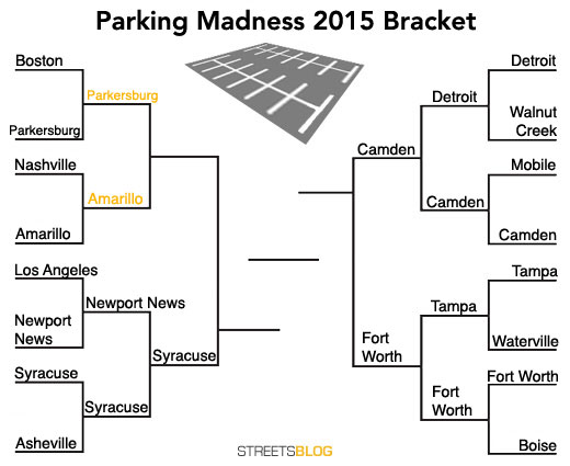
Parking Madness Elite Eight: Parkersburg vs. Amarillo
There’s just one spot left in the Final Four of Parking Madness, and it’s going either to Parkersburg, West Virginia, or Amarillo, Texas.
Gaze upon on these sad city spaces and despair. Then vote to decide who should stay in the running for the Golden Crater.
Parkersburg, West Virginia
This small Appalachian city overcame a parking wasteland by the Boston waterfront in the last round. Submitter Elliott Lewis says of this area of Parkersburg:
Here is my submission for the Golden Crater, aptly named “Park”ersburg, WV. With a population around 31,000, it is the fourth-largest city in West Virginia and my hometown. This town has seen Native American raids on settlers (and vice versa), George Washington surveying, planned treason by Vice President Aaron Burr (check out the history of Blennerhassett Island), Civil War soldiers, some of the first governors of WV, Wright Borthers flights, birth of the country’s oil and gas industry, important transportation hubs, large-scale hardware and chemical manufacturing, and countless historical events. Those which took place downtown are likely under asphalt (like the home of the first governor of our state).
By my calculations, including street and sidewalk ROWs, the total amount of land in downtown Parkersburg is approximately 61% paved. Of the developable land in this same area (not counting streets), about 50% is dedicated surface parking, most of which is monthly rentals. Yup, the only short term parking is on-street, in one garage, or in a newly-built parking lot off of 6th St. They dedicate half their land to surface parking. Ugh.
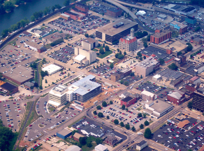
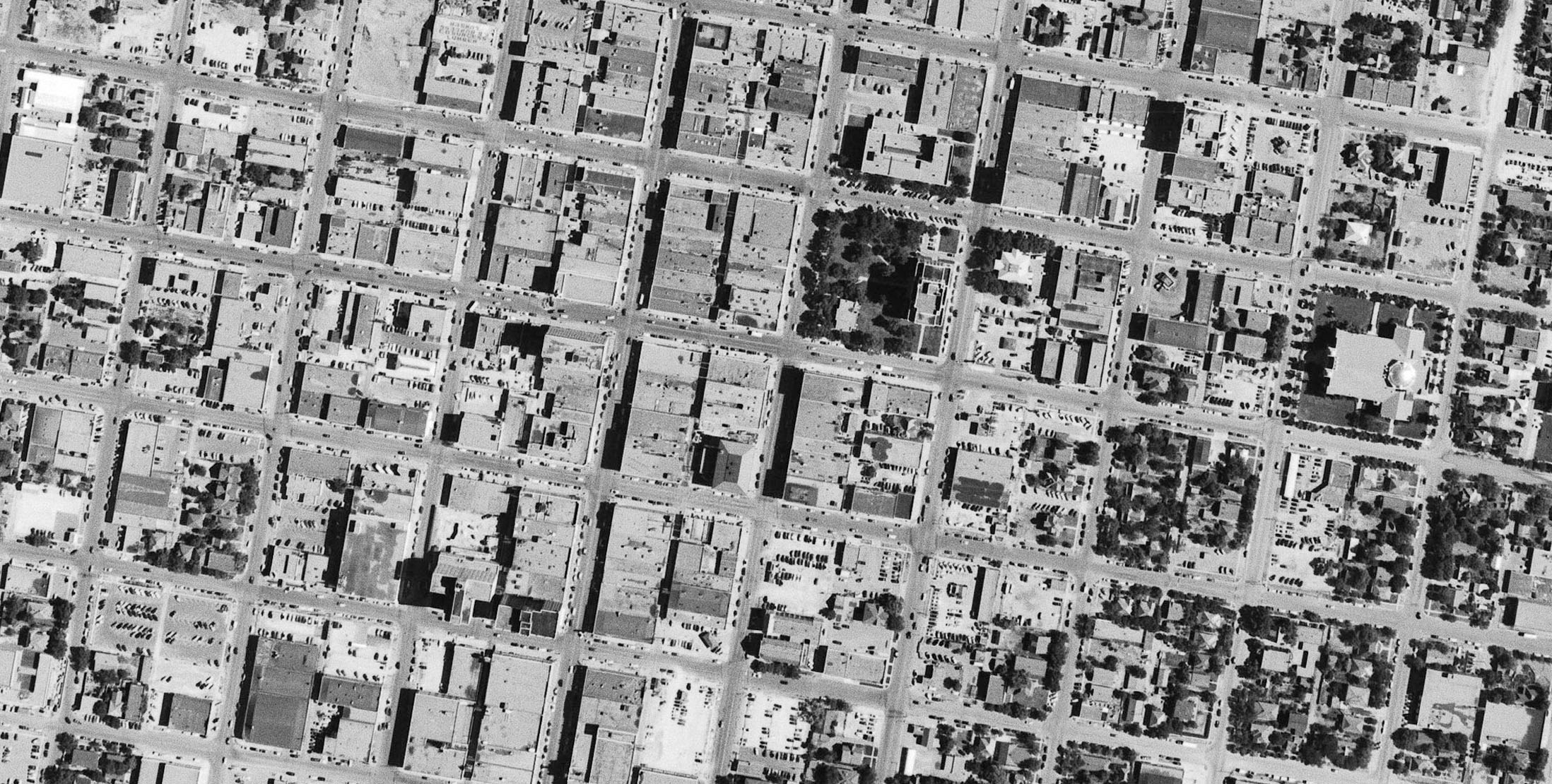
The area in question, besides the entire downtown area, is that from 4th Street to the Little Kanawha River. Much of this is dominated by City, County, and Federal government services and includes the County Courthouse (beautiful Romanesque revival) and the Municipal Building (no so beautiful). From the Google Maps link, it shows some buildings currently demolished; the entire block between Juliana/Market/1st/2nd is paved, as will the building across Market Street abutting 2nd St (the old jail). And to make matters more depressing, the area is bounded by elevated railroad tracks near Ann St., an at-grade railway, and a concrete floodwall. I’ve included an aerial screenshot from Google Earth, the same with parking highlighted, and a couple of photos (a couple of historical ones and one from 2005 – note that the buildings toward the top of this photo are now demolished). Enjoy.
Here — thanks to Shane Hampton at University of Oklahoma’s Institute for Quality Communities — is an aerial photo of the area in 1968.
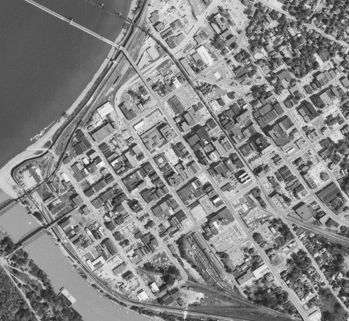
You can see the beginnings of parking decay, but nothing like the total decomposition of today.
Let’s see how Amarillo stacks up.
Amarillo
Amarillo’s crater beat out Nashville in the first round. Nick Sortland, who explains:
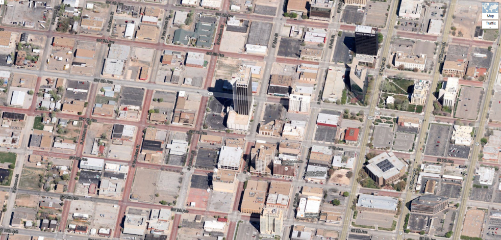
Amarillo has one sad center for a city, which according to wiki has always had steady population growth, but strangely a very much dying urban center. I went there once to visit relatives, and all that I can remember is that it was large, flat, and brown. Even when coming from Fargo, ND, Amarillo made that look like a green lush paradise compared to the hard dirt of the Texas panhandle.There is a funny thing about the part of the country from around Tulsa down through this part of Texas: it all looks burnt to hell by the sun in 45 degree view, street level retail is almost completely absent, and the traffic engineers have been kind enough to redesign nearly every road into a one-way for maximum efficiency, which almost certainly assures maximum pedestrian bleakness.I don’t know if this is some kind of hold over from the prior rancher attitudes of these places, with a desire for your own private land to defend to the death in a shootout, but these places all seem incredibly dead, with a huge absence of any kind of public space.
Here’s what this area looked like back in 1953:
Which city should advance to the Final Four? Let us know below.

Read More:
Streetsblog has migrated to a new comment system. New commenters can register directly in the comments section of any article. Returning commenters: your previous comments and display name have been preserved, but you'll need to reclaim your account by clicking "Forgot your password?" on the sign-in form, entering your email, and following the verification link to set a new password — this is required because passwords could not be carried over during the migration. For questions, contact tips@streetsblog.org.