The Interstates Did Not Need Villains; They Had Criteria

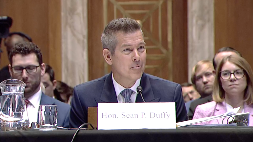
The following article was adapted from The Story of Urban Planning by Ivis García and Jason Holt (Caracara Press, 2026), which tells planning history as one connected narrative rather than a set of disconnected movements. Available in print and ebook.
When states were first deciding where their interstates should go in the years right after the Federal-Aid Highway Act of 1956, the Bureau of Public Roads worked from a route-selection standard that more or less came down to this:
Choose the route that minimizes construction cost, maximizes traffic capacity, and connects the urban core to the suburban ring in the least travel time.
When we read this sentence today, it’s not hard to see where we went wrong.
At the time, the cheapest land in an American city sat in older, denser, lower-income neighborhoods: the same ones urban renewal was already clearing for the same reason. The path of least political resistance ran through communities with the least capacity to fight a federal program backed by billions of dollars and every state highway department in the country.
No one had to name a target. The criteria did the selecting, in dozens of unrelated cities, with a consistency no individual decision can explain.
The idea that there’s one “villain” in the story of how the interstates were built is more satisfying, and more comforting, because villains can be defeated and then they are gone. Robert Moses, the unelected official who ran New York’s major public works for more than three decades, routed the Cross Bronx Expressway straight through dense Bronx neighborhoods. He lost his power in 1968 and died in 1981.
Criteria, by contrast, do not die. They get reauthorized.
That’s not to say Moses didn’t have a harmful impact, or that his specific reasoning isn’t worth reading closely. For the Cross Bronx Expressway he had an alternative, a route slightly south through industrial land that would have taken fewer occupied buildings and displaced fewer families. He knew it existed. He chose the northern route anyway.
Robert Caro, whose 1974 biography of Moses, “The Power Broker,” remains the standard account of his work, went through that decision in detail and found no tidy explanation. He noted just that Moses did not revisit a route once he had committed to it, and that objections from the people in the path carried little weight with him. Construction ran fifteen years, and estimates of the number of displaced along the seven miles run from forty thousand to sixty thousand people.
What followed was a loop rather than a single catastrophe. The elevated structure made the streets beside it loud, which made them less desirable, which moved out the families who could afford to move, which thinned the tax base, which thinned the services, which made the neighborhood less desirable still. The South Bronx of the 1970s had many authors. The expressway concentrated them in one place and sped them up.
The same arithmetic ran everywhere. In Nashville, Interstate 40 took 650 homes and 27 apartment buildings on the North Side, split a self-sufficient Black commercial district in two, and survived a federal court challenge brought by residents and Fisk University.
Read about the “freeway revolts,” the neighborhood campaigns that fought urban highway routes as soon as they were announced and stopped them outright in cities from San Francisco to Baltimore, and you’ll find people who understood this better than the profession did.
Their argument was not against highways. It was about criteria: that the traffic benefit was smaller than the models claimed, the damage to the urban fabric never appeared on the ledger at all, and the people in the path held an interest the process had no way to count. Those freeway fighters were right about the models. Urban highways induce the traffic they are built to carry, filling to capacity as the access they provide encourages more driving.
Those criteria have followed us into the present. Houston is the clearest case running today.
The North Houston Highway Improvement Project will take 168 single-family homes, 1,067 apartment units, 331 businesses employing nearly 25,000 people, four houses of worship, and two schools. Through downtown, the right of way grows from 220 feet to 570 feet. The cost has gone from about seven billion dollars to thirteen billion, with completion now projected around 2040. The engineering is better than anything available in the 1950s. The ledger still has no column for a congregation that loses the building it worships in.
That is what the spine of my book, The Story of Urban Planning, is drawn from. In chapter after chapter, planners identify a real problem, act on it with the best tools and knowledge their era hands them, and solve it. Then the solution becomes the problem which the next generation inherits.
Which brings me to the part that should trouble everyone reading this, including me. Reforms outlive their moment the same way criteria do. The public review processes built to curb the harms of highways are now the ones used to stop projects that would make cities better.
The freeway revolts won a real victory in the Federal-Aid Highway Act of 1962, which required a continuing, comprehensive and cooperative planning process, and in the participation requirements that followed. Those requirements worked. They also became the instrument that now blocks the apartment building, the bus lane, and the infill housing that would take pressure off the fringe. The same tool, pointed at different targets, now protects the status quo instead of the people in the path.
That is not an argument for taking public participation away. It is an argument that we reformed the process and left the criteria alone, which made it harder to build everything instead of harder to build the wrong thing. Sixty years later, we are still optimizing travel time and still counting displacement as an acquisition cost.
Ask what your region’s decision rule rewards. Then ask what it has no way to count. That second list is where the damage happens.

Ivis García, Ph.D., AICP, is an associate professor of landscape architecture and urban planning at Texas A&M University, where she coordinates the Master of Urban Planning program. She is the co-author of The Story of Urban Planning (Caracara Press, 2026).
Read More:
Streetsblog has migrated to a new comment system. New commenters can register directly in the comments section of any article. Returning commenters: your previous comments and display name have been preserved, but you'll need to reclaim your account by clicking "Forgot your password?" on the sign-in form, entering your email, and following the verification link to set a new password — this is required because passwords could not be carried over during the migration. For questions, contact tips@streetsblog.org.