Talking Headways Podcast: The Bikeable Forest Of Texas (Yes, Texas!)
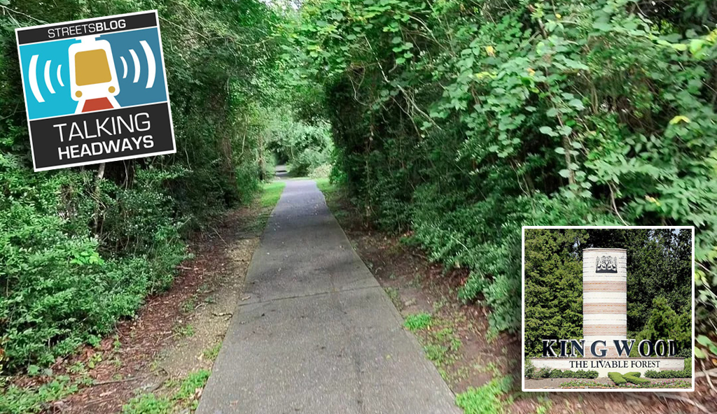
This week we’re finally doing it! We’re going to Kingwood, Texas, and talking about the greenbelt trail system I’ve been telling everyone about for years. This is a storytelling episode, featuring guests John Walsh, Jerry Lunow, and Bill Neuhaus, so I hope folks enjoy hearing about NASA, timber companies, bike trails, and Houston’s bayous. But also, stick around to hear how a suburban development in Texas from the 1970s mirrors and pre-dated Dutch bike planning with special guest, Steve Vance from Streetsblog Chicago.
Now, as you know at Talking Headways, we offer you three ways to enjoy our fine content:
- Read the full transcript (with a few AI typos) by clicking here.
- Reading an edited segment below the player on this page.
- Or simply putting in those AirPods and clicking the audio player below to get the full dulcet tones of our host and his guests:
Here’s the partial excerpt:
Steve Vance: I did not think about the benefit of living in Houston when we moved there. It only came to light when we moved away from Kingwood in 1996 to Batavia, Illinois.
And then my perspective and appreciation for the design of Kingwood changed again when I visited Houten in the Netherlands in 2011, where I recognized some of the design principles in Houten were actually present in Kingwood. And I was shocked that somebody in the ’70s had this idea that has been replicated 4,000 miles away at around the same time, but also I think in Davis, California, there are some parallels between Kingwood and their bike path system and Davis’s bike path system.
Jeff Wood: Throughout the production of this episode, I couldn’t shake thinking about how the United States and the Dutch diverged in the 1970s. In 1973, an oil crisis hit and prices spiked. To many people, this is a line of demarcation. Gary Nelson notes that 1973 is the year that petroleum killed America, and auto-oriented sprawl clearly won out over communities designed for active transportation like walking, biking, and transit.
Some countries, such as the Netherlands, made deliberate choices, moving towards less energy-intensive modes as the United States shifted further towards auto dependence. In 1979, with more oil embargoes and the election of Ronald Reagan, auto dependence and urban sprawl were set in stone for another generation.
Steve and I enjoyed a rare Texas bubble, a place where you could bike everywhere if you wished.
Steve Vance: Growing up there, I was a free-range kid before that phrase even existed. And I had a bicycle, and I was able to ride my bicycle to any of my friends’ houses in other subdivisions and ride it to the grocery store, which I think was called Randall’s at the time, and the library and school and the pool in my subdivision or in my friend’s subdivision because there was a greenbelt trail system, a network that was grade separated through the forest.
And then when I moved to Batavia, like, I was put on lockdown. I was not allowed to bike to certain parts of Batavia or Geneva. There’s a road in that part of Illinois called Randall Road. It probably has a state highway number. But I was not allowed to cross that road. And the thing is, the grocery store was on the other side of that road, and thus I was severely restricted.
Things that were normal for me to do in Kingwood, I was not allowed to do in Batavia because Batavia had very little bike infrastructure, had almost no on-street bike lanes, although Kingwood didn’t have any because it had such a robust trail network. And then the middle school that I attended in Batavia was built on a greenfield site at the edge of town, and so I either had to take a bus or one of my parents had to drive me
Jeff Wood: Steve wanted to bike and walk. But as kids, we didn’t know why we couldn’t or what was really different aside from the fact that one place had accessible transportation and the other really didn’t.
Steve Vance: So later the Dutch Consulate sent planners to come to Chicago to work with the Chicago Department of Transportation’s bike lane designers and planners.
And some events were open to the public, and so I attended one where one of the Dutch planners explained this layered network system. So there’s a network of roads for cars and vehicles, and there’s a separate network for biking, and they will intersect at certain points and you make certain treatments so that those intersections are safe.
But between points, you have completely separate networks. They don’t have to be the same network with the bike path and the road in the same alignment. You can separate them. It was neat to learn in like 2010 that there was a name and a concept and a process for doing what I had experienced as a child in Kingwood for five years.
These Dutch planners would say, “Get a map out. Mark the points of interest that you’re trying to promote cycling to, and draw straight lines between them.” So you can see the beginning of a network. Obviously, you can’t build bike trails in a straight line because there are buildings and natural resources in the way, and so then you try to draw the straightest line possible between the two points.
And so if you look at a map of Kingwood and you mark all the playing fields and the schools and the pools, it’s, it’s basically the whole bike path or multi-use path, the Greenbelt Trail, was designed to just connect all of those things. It hit every point that someone like me or my sister needed to go to frequently on our bikes.
The network was there for that.

Read More:
Streetsblog has migrated to a new comment system. New commenters can register directly in the comments section of any article. Returning commenters: your previous comments and display name have been preserved, but you'll need to reclaim your account by clicking "Forgot your password?" on the sign-in form, entering your email, and following the verification link to set a new password — this is required because passwords could not be carried over during the migration. For questions, contact tips@streetsblog.org.