Anyone Can Redesign a Street. Here’s How.
Editor’s note: this article originally appeared on Urbanism Speakeasy and is republished with permission.
Anyone can design a street using two user-friendly tools: Google Maps and Streetmix. That’s good news because planners and engineers need practical ideas to rearrange street space. The point isn’t to do the civil engineering work for them, or analyze the intersection operations for them, or determine where exactly bus stops should be. There is value in technical expertise. But the experts need ideas, because for a variety of reasons, they aren’t pushing good street design in their consulting or their local government jobs.
Here’s a 5-step walk-through of how anyone with an internet connection can become an ideas machine. You can do this on your phone, but it’s much easier on a laptop or desktop computer.
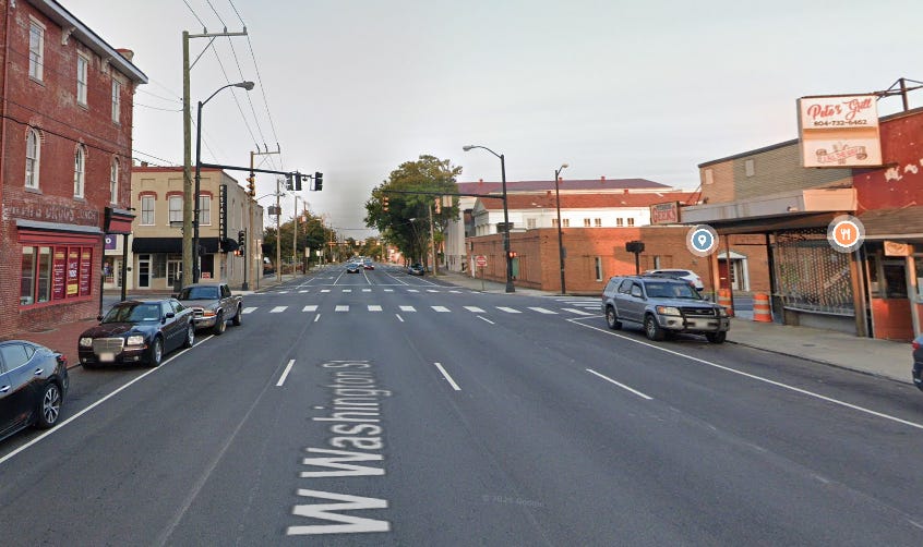
1. Take a screen capture of the street view on a corridor you’re interested in.
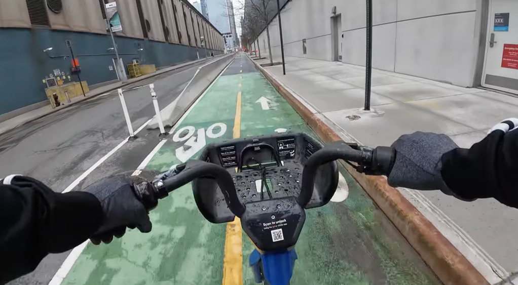
I chose Washington Street in Petersburg, VA. It’s an old city on the Appomattox River with lots of heartache but huge potential. The downtown streets look like a highway ripped through.
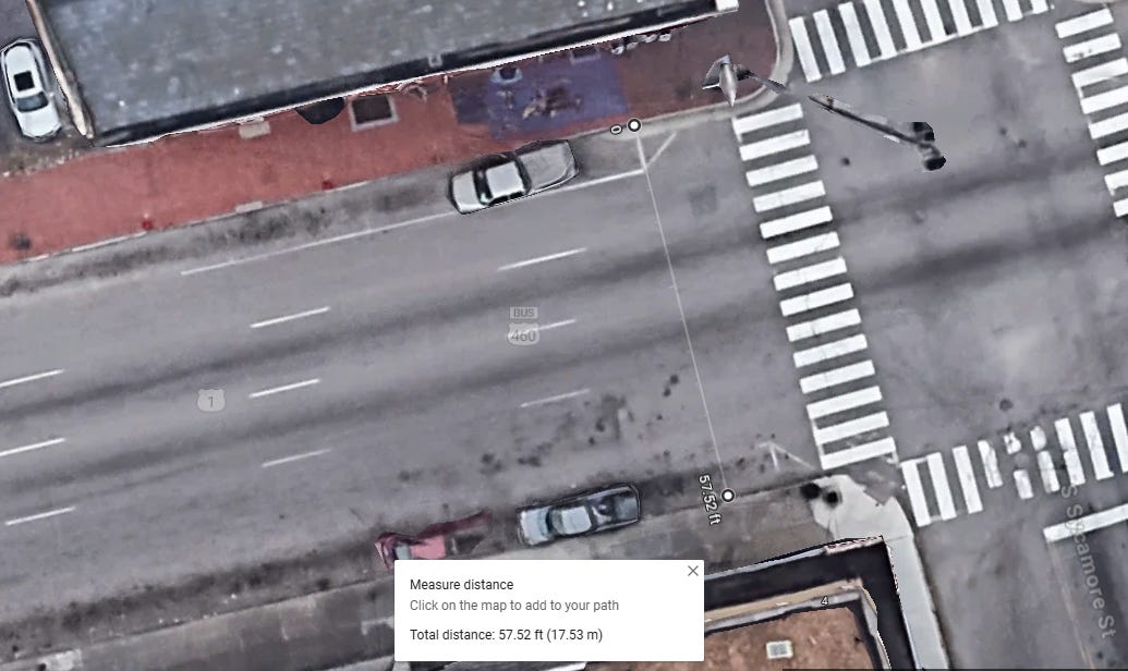
2. Use the Google Map measuring tool to estimate the curb-to-curb distance.
On the map view, change the layer to aerial. Right click on one curb and select “measure distance.” Left click on the opposite curb. Google tells me my street is 57.52 feet, so I’ll round down and call it 57.
3. Create a typical section in Streetmix.
At the top-center of your Streetmix page, change the street width to whatever curb-to-curb distance you measured. Mine is 57 feet. For this exercise, I’m not concerned about the outside-the-curb land use for now. Sidewalks, outdoor dining, bus stops, building types… save that for later. Focus on the street space.
4. Drag-and-drop travel lanes.
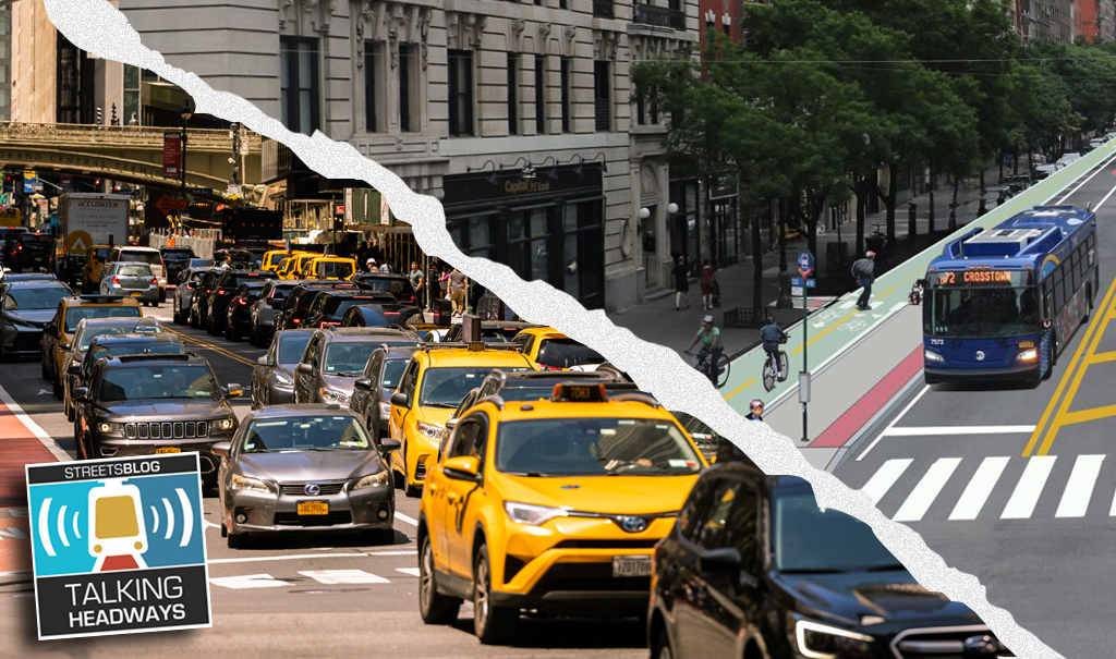
Add general purpose lanes, transit lanes, bike lanes, and then adjust the width of each. This is an important step because most transportation professionals will insist all vehicular lanes need to be 12-feet wide. That’s not true. Even the most status quo engineer defending their holy books of engineering will have to admit that their two leading sources for guidance, the US DOT and AASHTO, encourage narrower lanes in population clusters.
A good rule of thumb is 10-foot “normal” travel lanes and 11-foot lanes that have heavy truck or bus traffic.
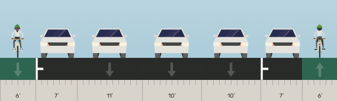

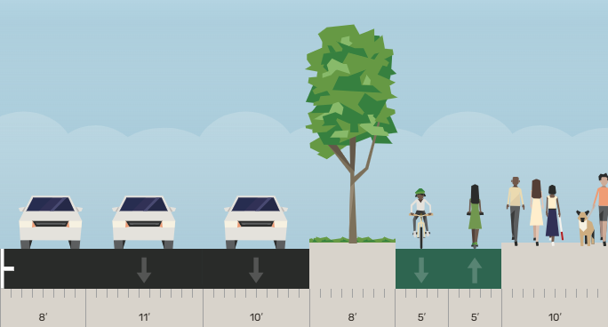
Washington Street is one-way. Even if you only remove one of the four (!) general purpose lanes and keep on-street parking on both sides, there’s ample room for protected bike lanes on either side.
5. Make multiple designs.
Take it a step further and transform the street to a comfy place that’s more inviting. Here’s a layout with two general purpose lanes, street trees, and on-street parking on both sides of the street.
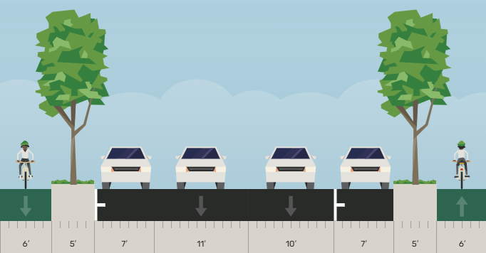
Again, everything in the Streetmix illustration is within the 57 feet of existing curb-to-curb public street space. If you have a one-way corridor like Washington Street, you could also experiment with making it two-way. Or maybe your parking lanes need to be 8-feet wide, or maybe you want a multi-use trail on one side instead of traditional sidewalks and bike lanes.
Play around with Google Maps and Streetmix and share your ideas. My favorite experience with these was at a public meeting where the consultant team brought a laptop and printer, and everyone attending took a turn designing a corridor and taping it to the wall. Sometimes the experts are ahead of the curve.
Plan the city you want, not the one you think is inevitable.

Read More:
Streetsblog has migrated to a new comment system. New commenters can register directly in the comments section of any article. Returning commenters: your previous comments and display name have been preserved, but you'll need to reclaim your account by clicking "Forgot your password?" on the sign-in form, entering your email, and following the verification link to set a new password — this is required because passwords could not be carried over during the migration. For questions, contact tips@streetsblog.org.