Parking Madness 2017 Tip-Off: St. Louis vs. Sacramento
Welcome to the first match in the first round of Streetsblog’s 2017 Parking Madness tournament, our 16-city bracket highlighting the worst “parking craters” in North America.
This year, we’re focusing on a specific type of parking disaster: transit stations engulfed by car storage. Transit works best when people can walk to stations — more people will ride and fewer will drive. A moat of parking defeats the purpose and repels people on foot, but that is exactly what you’ll find at a shocking number of American transit stops.
We asked readers to submit the worst parking disasters near transit stops, and they did not disappoint. We had to cull some stunningly awful parking craters to get down to a field of 16. By the end of the tournament, we hope these cities start to rethink their parking and development policies.
We begin the competition with St. Louis vs. Sacramento.
St. Louis — Richmond Heights Metrolink Station
Here’s the Google Earth view of the Richmond Heights Metrolink Station outside of St. Louis. Like many of the submissions this year, this transit stop is also right next to a highway. Another highway and drive-to shopping complex is just below the frame of this shot.
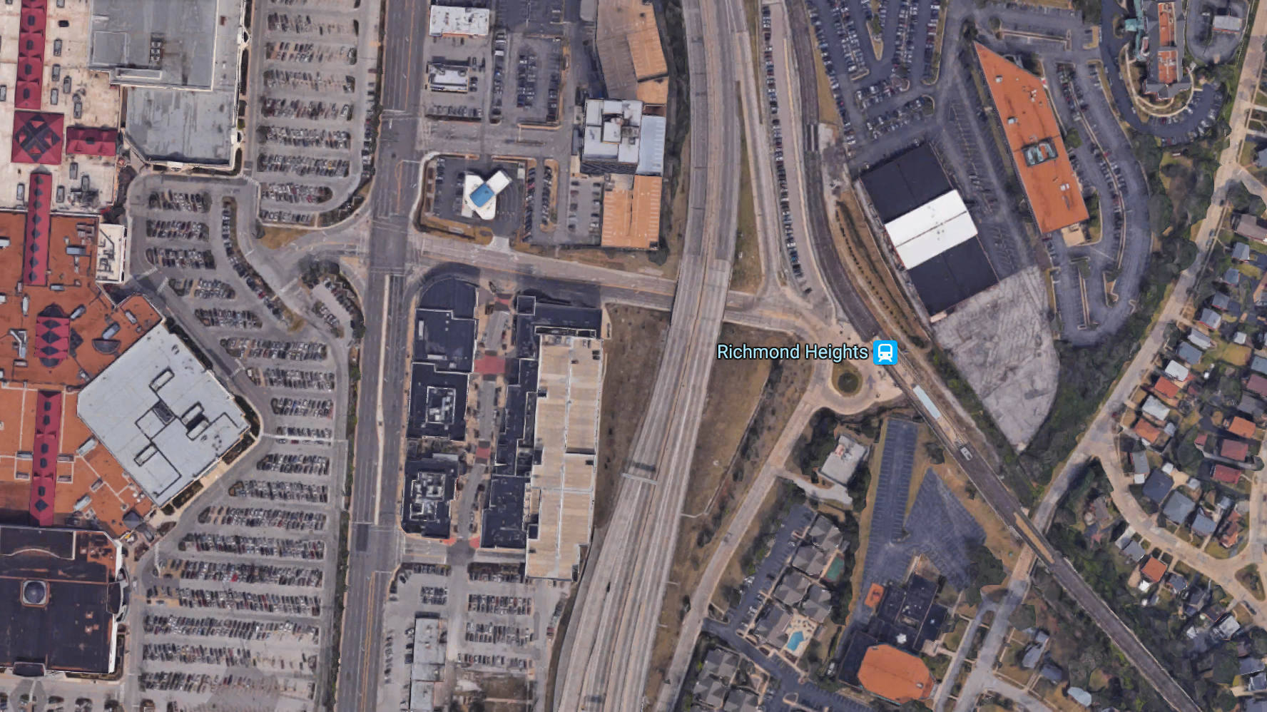
Reader Jack Painter submitted this entry and describes the complicated walking logistics near this stop (follow along here):
Over 150 homes are in the center of the picture that are walled off by highways 170 and 64 and MetroLink train on the east. Therefore to walk 500 feet from the corner of Bryan Ave and Kurt Ave, to Trader Joes and numerous other stores/restaurants requires walking 1.8 miles via going south on Bryan, north on E. Linden, east on Clayton Rd, south on Hanley Rd and then south on Eager Rd.
Before building the New 64, a pedestrian bridge was over 170 at Antler Dr that was removed and not replaced by MoDOT.
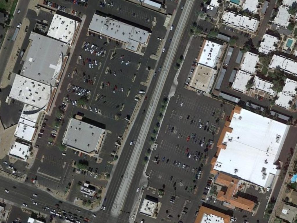
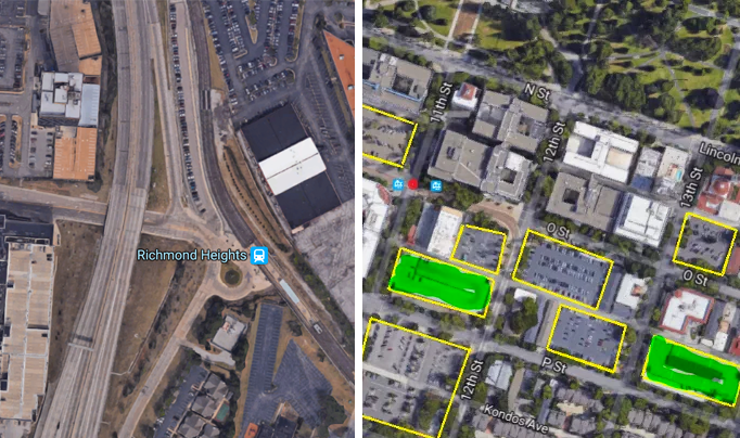
Sacramento
Statehouses — and Capitol Hill, for that matter — are highly susceptible to parking craters, as we’ve seen in Washington, D.C. and Hartford.
This one is right around the California state capitol in Sacramento. Reader Jim Adams makes his case:
Around two major light rail stations downtown, just south of the capitol (8th and O, Archives Plaza/DMV at 11th and O) there is way, way too much parking for the state office buildings. I count 8 surface lots (yellow) and five parking structures (green) within three blocks of the stations (red dots between the blue icons on the attached image).
We don’t have much of a transit system in this town (but do have the second highest fares in the nation), but the light rail carries significant numbers of workers downtown each weekday. More housing or employment on these lots would juice up demand for the system, considering the recent decline in ridership. We are focused on doubling the population of our downtown area over the next eight years, but these are mostly parcels controlled by the state of California, which is more antiquated in its travel preferences and urban planning.
Vote below to decide which is the worst waste of a transit station.

Read More:
Streetsblog has migrated to a new comment system. New commenters can register directly in the comments section of any article. Returning commenters: your previous comments and display name have been preserved, but you'll need to reclaim your account by clicking "Forgot your password?" on the sign-in form, entering your email, and following the verification link to set a new password — this is required because passwords could not be carried over during the migration. For questions, contact tips@streetsblog.org.