This article is a part of our annual Highway Boondoggles series, in partnership with U.S. PIRG. This series will explore some of the worst planned highway projects across the country, and explore why they deserve to be cancelled — and why U.S. transportation policy must be reformed to discourage similar initiatives in the future. Learn more about the other boondoggles that made this year's list by clicking here. You can also view the full report here.
Erie Bayfront Parkway
Cost: $66-$100 million
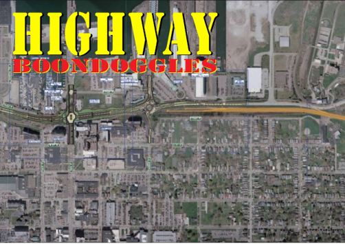
In the early 1990s, the Pennsylvania Department of Transportation built the Bayfront Parkway, a two-lane road connecting Interstate 79 with the Lake Erie bayfront of Erie, Penn. The highway was pitched as needed to spark redevelopment of an area suffering from economic decline. As one area business owner told the Erie Times-News, “the bayfront highway will pull in all the traffic from Pittsburgh on I-79 and bring it right to us.”
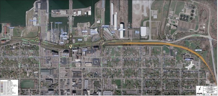
Thirty years later, after a few major projects such as construction of a convention center and later the associated hotels, the revitalization of Erie’s bayfront finally appears to be underway with multiple projects at once. However, the Bayfront Parkway has become an impediment, rather than an asset, to that revitalization, and especially to Erie residents’ ability to participate in and benefit from it. The road remains largely used as a high-speed bypass of downtown Erie’s street grid. Unfriendly and dangerous to pedestrians and cyclists, the parkway represents a barrier between the bayfront and the city’s downtown and flanking neighborhoods.
Now, PennDOT is pursuing an expensive redesign of the highway focused on further clearing the way for car traffic through the area – a project that some residents believe will again spend vast sums of public money without reconnecting the city with its bayfront.
The value of a highway along the bayfront has been questioned by local residents from the very beginning. The highway’s original 1984 draft environmental impact statement summarized public comment about the project, finding that “many residents expressed a general concern over whether the project is really needed” and suggested that the money spent on the highway could be “used for other things such as railroad service, fixing potholes and streets in general, or social programs."
Community concerns continued after the highway was completed, and especially once connected at its eastern end to a new freeway linking it to I-90 in 2005, enabling the parkway to be used as a bypass. In the mid-2000s, PennDOT commissioned a study of the highway and solicited feedback from local residents and stakeholders. Among the problems identified were that the road was seen as “unsafe for pedestrian travel” and “isolates residents from waterfront.” Excessive speeds on the road were also a concern. A previous 2005 study found that Erie’s highway network was overbuilt, showing that “east-west movements through Erie require approximately seven to eight lanes of arterial roadway, and there are presently 15 lanes available.”
Planning studies in the mid-2000s advocated for diverting through traffic off the parkway and onto other roads and streets, with one 2005 study suggesting converting much of the parkway to a boulevard with slower speeds.
Instead, PennDOT has proposed a plan with a cost of as much as $100 million that claims to “improve the pedestrian, bicycle, transit, and passenger vehicle connection” between the city and the bayfront while “improv[ing] future congestion,” but the proposed design instead actually focuses on expensive measures to separate vehicles and pedestrians that could increase vehicle speeds and attract more bypass traffic.
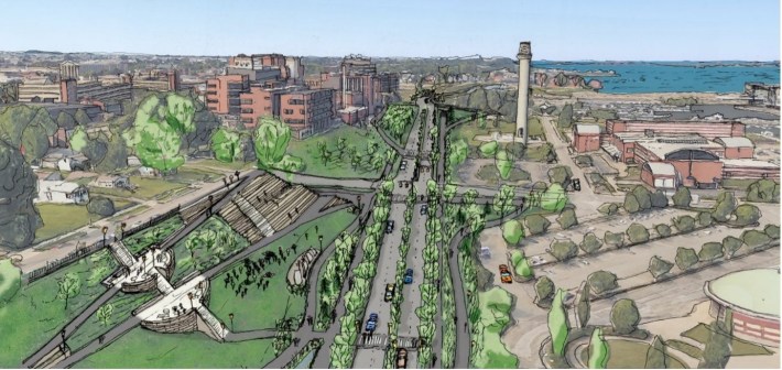
Included in the project are a new underpass with freeway-style exits beneath State Street – one of the main connections between the bayfront and downtown Erie — as well as other pedestrian bridges, and new two-lane roundabouts designed to prioritize vehicle travel. Rather than divert through traffic away from the parkway, PennDOT assumes that traffic on the road will skyrocket, with 80 percent of that traffic continuing to be drivers using the parkway to bypass downtown Erie rather than to access locations along the bayfront. Average daily traffic along the road is forecast to balloon from 16,000 vehicles a day currently to 29,000 vehicles per day by 2034 – an increase of 81 percent. That is despite the fact that traffic on the parkway actually declined between 2005 and 2018.
The removal of surface crossings for pedestrians and cyclists reduces conflicts with vehicle traffic, but would also require people walking and biking to travel farther — and often cross long pedestrian bridges — to reach their destinations on the other side of the parkway. Furthermore, the greater level of traffic — if it materializes — will likely increase the noise and pollution burdens of nearby neighborhoods, including the predominantly low-income East Side neighborhood, whose already limited pedestrian access to the bayfront is unlikely to be significantly improved by the expensive project.
In an effort to expedite the project, PennDOT applied for and received a categorical exclusion from review under the National Environmental Policy Act, eliminating the need for the agency to consider the full impacts of the proposal and to evaluate alternatives before commencing construction. The local chapter of the NAACP and the environmental organization PennFuture have filed suit against PennDOT and the FHWA to force a full environmental assessment of the project, consistent with federal law. EarthJustice is representing the organizations in the case.
Meanwhile, local residents continue to advocate for a new vision for transportation in the area that prioritizes pedestrian and bicycle connections between the neighborhoods and the bayfront over one that aims to speed drivers through the area as quickly as possible.
