Skip to Content
Streetsblog USA home
Log In
Civil Rights

Philly’s Most Dangerous Roads are in Poor Areas

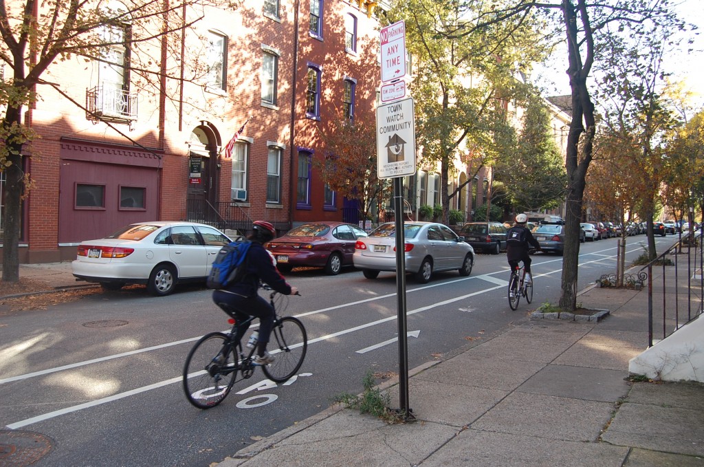
Safe streets like this in Philadelphia are not the norm in low-income neighborhoods, a new study reveals. Photo: ##http://bicyclecoalition.org/our-campaigns/biking-in-philly/spruce-and-pine-street/#sthash.T6ljm6kF.dpbs##Bicycle Coalition##

Low-income people and people of color are disproportionately on the mean streets of Philadelphia.

A new analysis from the Bicycle Coalition of Greater Philadelphia showed that less white and less affluent neighborhoods comprise 49 percent of the city's most dangerous streets — despite containing only about 35 percent of the city's total street mileage.
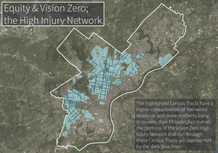
Low-income neighborhoods with higher than average non-white populations show in light blue. "High Injury Network" streets shown in dark blue. Map: Bicycle Coalition of Greater Philadelphia

The analysis reviewed the city's "High Injury Network" — the 12 percent of streets in the City of Brotherly Love that account for 50 percent of traffic injuries.

"Neighborhoods that lie in impoverished communities of color happen to be the most dangerous neighborhoods in Philadelphia, which is what we thought going into this," the Bicycle Coalition's Randy LoBasso told Streetsblog. "We believe it’s imperative that the city and nonprofits like ourselves continue to work in those neighborhoods and continue to prioritize these neighborhoods."

The disparity between the haves and have-nots is alarming, but neither unusual nor unexpected. The same pattern is found in many cities. In general, high-poverty neighborhoods have about four times the traffic risk of high-income, according to a Governing Magazine analysis from 2014.

Take a look at this Center for Urban Transportation Research map of Broward County, Fla [PDF], which charts both traffic crashes and low-income neighborhoods.
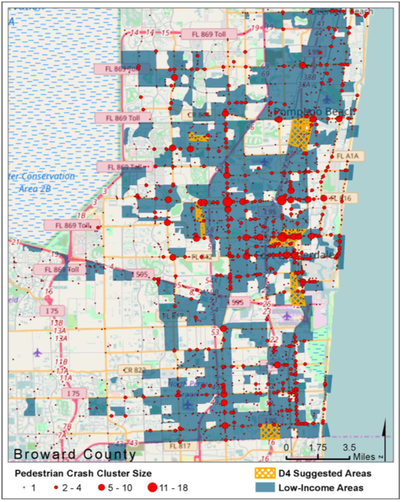
D4 areas are areas Florida DOT's Fourth District have suggested for interventions. Map: CUTR at University of South Florida.

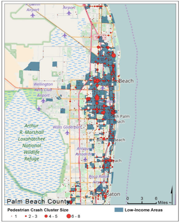
Same pattern in Palm Beach County.

palm beach
Map: CUTR

This is why cities are increasingly making "equity" a key platform of their Vision Zero plans.

"The first step in having a truly equitable Vision Zero program is to realize that, 'the concentration of traffic safety problems are not accidental, but rather the result of patterns of disinvestment and under-investment in certain communities, particularly historically black, brown, and immigrant communities,'" the Coalition wrote on its blog, quoting the first principle in the Untokening’s Principles of Mobility Justice [PDF].

"Communities are facing a myriad of challenges that stem from the historic disinvestment and structural racism," the Coalition added.

The organization has been hosting listening sessions in some of the worst affected areas.
Stay in touch

Sign up for our free newsletter

More from Streetsblog USA

It’s a Bird, It’s a Plane, It’s Wednesday’s Headlines

Is our Jetsons future is finally upon us? Plus, a new and better way to measure streets' level of service.

September 17, 2025

Op-Ed: Congress Has A Big Opportunity to Connect America By Intercity Bus

The next federal transportation bill could be a chance to connect rural America with buses like never before — and it will have spillover benefits nationwide, the CEO of one top bus company argues.

September 17, 2025

Breaking: US DOT Pulls Grants For Projects That Aren’t Focused on Cars

The Trump administration bias for "vehicular travel" — and the burning of fossil fuels that it requires — rears its ugly head again.

September 16, 2025

Seattle’s Human Population Is Up, But Its Car Population Isn’t

Urbanists have long been making that case that growth in Seattle is the most climate-friendly and easiest to support with transit and infrastructure. And it's happening.

September 16, 2025

Tuesday’s Headlines Stay Safe

Political rhetoric notwithstanding, you're much safer on a bus or a train than in a car, or walking or biking near cars.

September 16, 2025
See all posts