Here’s a New Street-Level Analysis of the Biking Networks in 299 U.S. Cities
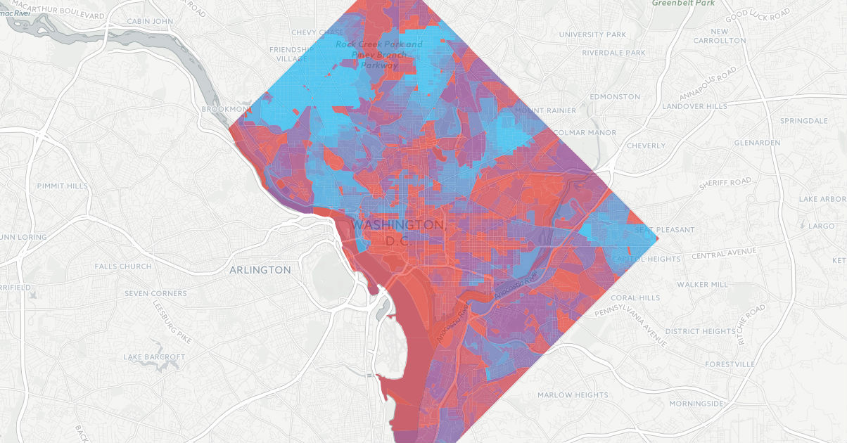
Bike Network Analysis score by Census block in Washington, DC. Bluer areas are better-connected.
It takes many things to build a good city for biking, but one of them is indisputably a nice mellow network.
Just as the car boom of the 1920s was made possible by new continuous networks of paved roads, the growth of biking in the next decade will depend on building continuous networks of wide or protected bike lanes, off-street paths, and low-traffic streets.
Just as importantly, bike networks need to go places -- they need to connect people to each other, to jobs, to public recreation and services, to private businesses.
The nonprofit I write for, PeopleForBikes, has just made the first attempt to measure and compare local bike networks on a nationwide scale.

The new PlacesForBikes Bike Network Analysis is a first-of-its-kind project and a work in progress. Using OpenStreetMap (a sort of Wikipedia for online maps) and the widely respected "level of traffic stress" methodology developed by Northeastern University's Peter Furth, we've developed digital records of the biking networks in 299 U.S. cities and assigned a numerical score to how well each one connects people to places.
To determine the stress level of a street (including its intersections), the BNA considers lane counts and widths (for both bike lanes and general travel lanes), speed limits, traffic signals and the presence of parked cars.

When the new PlacesForBikes city ratings are released this fall, the BNA score will be one of several components.
"What it measures is whether people can get to key destinations on a low-stress network," said Jennifer Boldry, Ph.D, director of research at PeopleForBikes and lead creator of the BNA. "That's kind of different from how good it is to bike, because I think there are many elements to the enjoyability of a bike ride."
Here's a short guide to exploring everything the BNA currently has to offer, including a video.
A surprise star for low-stress biking: America's small towns

One interesting phenomenon turned up by the BNA: Many of the top-scoring cities have very small populations. Some of them hardly have any actual bike lanes.
"There's a handful of kind of small towns, unusual suspects that do really well," Boldry said. "In all of those places, you have a ton of low stress connections in big bulk right in the middle, and that's where all of the destinations are."
Clustering small businesses, public destinations and two-story housing on two-lane main streets -- the standard development pattern when many of the country's small towns were built -- turns out to be a good way to make a city bikeable.
"I think it advances the discussion around the importance of land use," Boldry said. "I think we're going to see that getting people to ride from A to B -- they have to have a B."
The Bike Network Analysis is only as good as OpenStreetMap's data

The BNA is far from perfect. One major shortcoming: It's blind to destinations that haven't been entered in OpenStreetMap.
For example, the city of Bismark, North Dakota, receives the country's eighth highest BNA score -- but that's in part because OpenStreetMap thinks the city has zero retail outlets, doctors, dentists, pharmacies or social services. Therefore, BNA doesn't attempt to score connectivity to those destinations.
Bismarck also has a BNA score of 54 for bike access to transit -- more than twice the transit score for DC or San Francisco. Bismarck's bus transfer stations may happen to be located on low-stress streets, but it's debatable whether its score reflects the experience of combining bike and transit trips.
Another issue is that the BNA can't see beyond city limits. For example, Alma, Michigan, population 10,000, gets the country's No. 2 BNA score: 71. That's bolstered in part by its nearly perfect retail access score of 91. But Alma's retail score ignores the city's most important retail outlet, the Walmart Supercenter on high-stress Alger Road, because it sits just north of city limits.
PeopleForBikes wants your feedback

Boldry says some issues like these are inevitable, and others may be fixable.
"The way we're thinking about it right now is that right now the maps and scores are truly a beta test," she said. "We're in sort of a review period until July 14, where we're soliciting feedback from cities and advocacy and anybody who is interested in this sort of thing."
You can help us improve the scores by completing this survey.
PeopleForBikes will pull fresh OpenStreetMap data and recalculate BNA scores in time for the city ratings this fall. But Boldry said the BNA methodology is likely to keep changing.
Ultimately, the goal is to make it easy for any U.S. city to do basic analysis of its network, find its weakest links, and measure the payoff from improving them.
"I think we're interested in making it as good as it can be, and for that to be true it has to be evolving," Boldry said.
PlacesForBikes is a PeopleForBikes program to help U.S. communities build better biking, faster. You can follow them on LinkedIn, Twitter or Facebook or sign up for their weekly news digest about building all-ages biking networks.
Stay in touch
Sign up for our free newsletter
More from Streetsblog USA
Talking Headways Podcast: Money is a Lot of Different Things
It's Part II of our discussion with Jim Kumon!
If Thursday’s Headlines Build It, They Will Come
Why can the U.S. quickly rebuild a bridge for cars, but not do the same for transit? It comes down to political will and a reliance on consultants.
Wider Highways Don’t Solve Congestion. So Why Are We Still Knocking Down Homes for Them?
Highway expansion projects certainly qualify as projects for public use. But do they deliver a public benefit that justifies taking private property?
Kiss Wednesday’s Headlines on the Bus
Bus-only lanes result in faster service that saves transit agencies money and helps riders get to work faster.
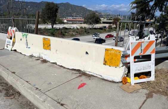
Freeway Drivers Keep Slamming into Bridge Railing in L.A.’s Griffith Park
Drivers keep smashing the Riverside Drive Bridge railing - plus a few other Griffith Park bike/walk updates.