If you ever want to show someone that it's possible to change streets and cities for the better, Google Street View can now help you do it.
Google recently made it possible to view archived Street View images. This means it's easier than ever to show what streets looked like before and after a redesign. (Thanks to the Institute for Quality Communities at the University of Oklahoma for bringing our attention to this new feature.)
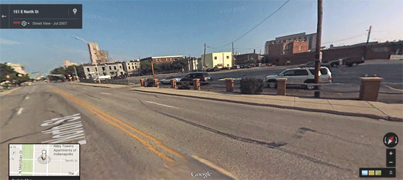
We were able to animate a few street transformations from around the country with the new Street View feature. Above you can see the arrival of the Indianapolis Cultural Trail on North Street. People for Bikes called the project the second-best protected bike lane in the United States.
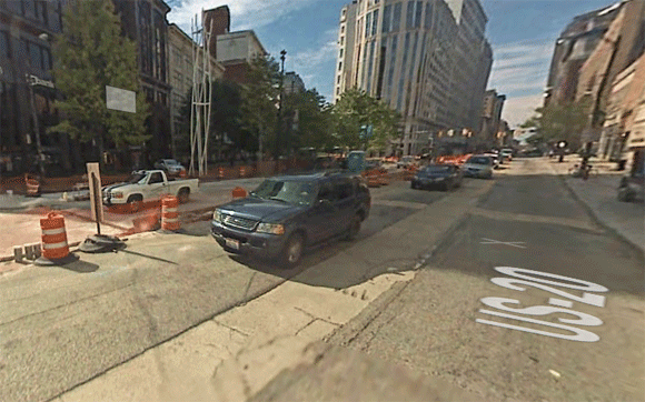
Allen Street on New York's Lower East Side features one of the city's most unique bikeways, which runs in the center of the street and is part of a boulevard-style median, complete with small plazas like this one in what used to be the middle of intersections:

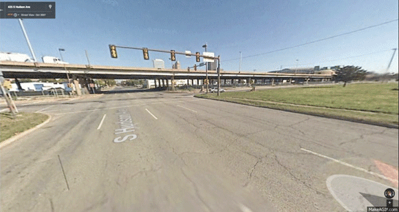
Here's I-40 in Oklahoma City before and after it was torn down. The city is planning to redevelop the area with a walkable, at-grade boulevard:
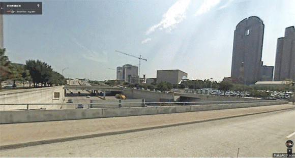
This is the 5.2-acre Klyde Warren Park in Dallas, which opened in 2012 after the Woodall Rodgers Freeway was capped:
Here's Cleveland's Euclid Corridor, during and after the installation of its Healthline bus rapid transit (the Street View shots come from somewhat different angles). The Healthline has been called the best example of bus rapid transit in the country, and locals credit it with helping spur billions of dollars in nearby development.
So that's a taste of how you can now use Street View to show how American cities are making streets better for people -- not just cars. If you've got other street transformations you'd like to share, tell us about them in the comments.