Michael Andersen blogs for The Green Lane Project, a PeopleForBikes program that helps U.S. cities build better bike lanes to create low-stress streets.
Downtown Pittsburgh has a perfectly good reason to be running out of room for more cars: Its streets have been there since 1784.
"In Pittsburgh, we have too many cars chasing too few parking spaces," Merrill Stabile, the city's largest parking operator, said last week. "I am in favor of building a few more parking garages. But we'll never be able to build enough to meet the demand, in my opinion, if we continue to grow like we've been growing."
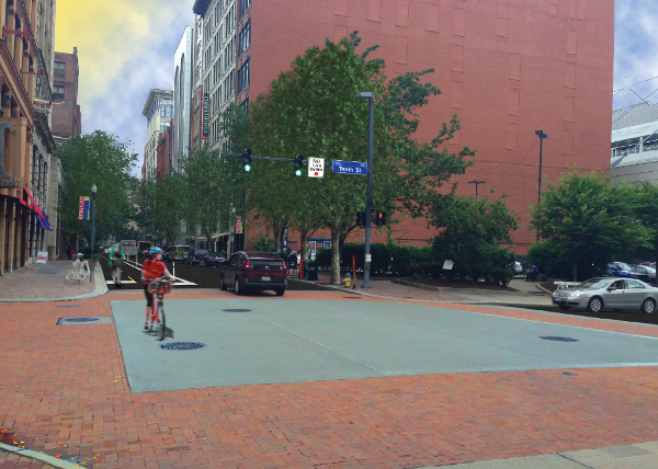
That's why Stabile is among the Pittsburgh business leaders backing a plan announced Tuesday to reduce downtown's dependence on car traffic by adding a protected bike lane to Penn Avenue.
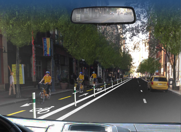
Jeremy Waldrup, CEO of the Pittsburgh Downtown Partnership, said the protected lane, which will return Penn Avenue to one-way motor vehicle flow by removing an eastbound traffic lane, will make it comfortable for most people, not just the bold few, to bike downtown.
"One of the most important things is that we have as a city developed this incredible trail system, many of them leading to downtown," Waldrup said. "But once you've made it to the borders of downtown, you're literally on your own to get into the city."
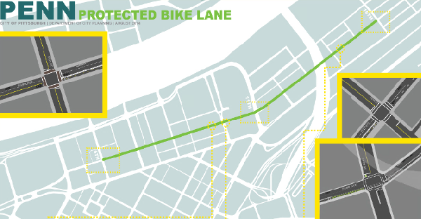
Penn Avenue's new one-mile bike lane, installed as a pilot project over the next few weeks, is part of a wave of protected lane projects in American central business districts.
And it's happening one of the country's oldest downtowns: a triangular grid built for horses and carriages that by 1900 had become the 11th-largest city in the United States — and has spent the century since then trying to find room for cars.
"The Penn Avenue corridor that we're looking at is kind of in the heart of our cultural district," Waldrup said. "Tens of thousands of people come into this area for culture."
Will Bernstein, who commutes daily into downtown Pittsburgh, agreed.
"You have the symphony, the opera more or less, you have a bunch of new restaurants," he said. "Convenience stores and stuff. There's actually a nice little park where they do concerts in the summers."
Like Stabile and Waldrup, Bernstein thinks the Penn Avenue bike lane will make it easy for families and casual riders to get downtown by trail and then venture into the retail core for entertainment, food, and shopping.
"For people who mostly just ride on trails, if they're riding the river trail and want to get into downtown from the point, Penn Avenue is kind of the natural route," he said. "If people want to have lunch, there's an ice cream shop, you know, stuff like that."
Protected bike lanes are part of the next step in Pittsburgh's recovery from rust-belt collapse, Allegheny County Executive Rich Fitzgerald said.
"We have a growing city after 25 years of managing decline," Fitzgerald said. "We’re now trying to figure out how to manage growth in a concentrated downtown area in which cars just can’t handle the load anymore."
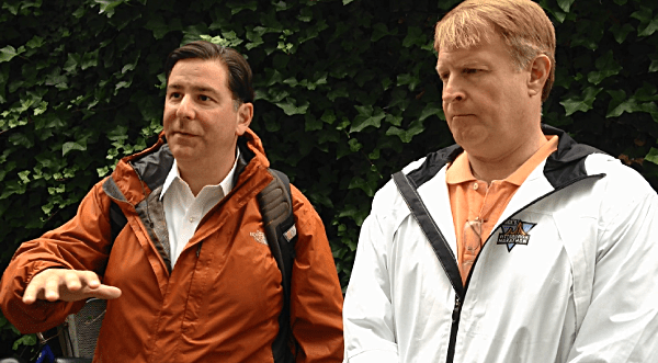
Penn is one of three protected bike lanes announced this summer by Pittsburgh Mayor Bill Peduto, who joined Fitzgerald and others for a Green Lane Project study tour of Denmark in June to see how protected bike lanes and other low-stress bike infrastructure have helped Copenhagen grow without generating ever-increasing car traffic.
Another of the three projects, a quarter-mile trail link on Saline Street in the Oakland area, was striped last week and lined with vertical posts, becoming the city's first protected lane. The third is just north of it, on Schenley Drive and Panther Hollow Road.
"On the East Coast, you know, we had cities that were built before the automobile and then we adapted them to be primarily used for the automobile," Peduto said in an interview. "And now we’re in that next phase, and we’re trying to figure out how all modes of transportation can work in a system."
You can follow The Green Lane Project on Twitter or Facebook or sign up for its weekly news digest about protected bike lanes.

