How Vancouver Designs Intersections With Bike Lanes to Minimize Conflicts
For the last installment of our series previewing the Pro-Walk Pro-Bike Pro-Place conference, which starts Monday in Pittsburgh, I talked to Jerry Dobrovolny, transportation director of the city of Vancouver, BC, about how the city designs intersections where there are protected bike lanes. (The interview has been lightly edited for clarity and length.) Members of his staff will be presenting on this topic next week.
Vancouver is famous for its livable urban core, the ease with which its citizens can live without a car (as 26 percent of downtown residents do), and its enviable investments in bicycling and transit. Read on and tell me: Don’t you wish your city’s transportation chief talked like this?
Tell me a little bit about how Vancouver designs intersections to minimize car-bike conflicts, and why a focus on intersections is important in designing good bike infrastructure.
Clearly, it’s conflict zones that require the most attention. For separated bike lanes, those conflict zones are either driveway entrances or intersections. Intersections have more interactions going on and that’s where most of the collisions occur.
Over the past number of years, as we’ve been on our journey here in Vancouver -- changing the types of infrastructure that we provide -- we’ve been looking around the world quite actively to learn from what others are doing, to see what’s working and what isn’t working so well. It was pretty tough for us a couple years ago, because we didn’t really have a lot of places to go in North America. When we launched our Transportation 2040 plan two or three years ago, we actually hired the bike planner from Copenhagen to help with the bike section.
Since then, in the last year and a bit, NACTO has done some amazing work, and there’s a whole variety of U.S. and Canadian cities that have done some really amazing work. So we’re having a much better dialogue between cities in North America now compared to three years ago.
I want to talk just a little bit more about the mechanics of the intersection design. I saw the Dunsmuir Street bike lane. Can you walk me through that one and what the engineering there accomplishes?
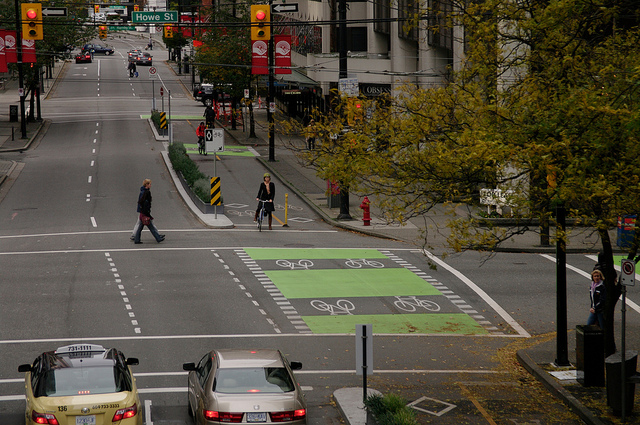
Dunsmuir was one of the first we did. We had opened this two-way separated bike route on the Dunsmuir Viaduct that then stopped at Dunsmuir Street, so that’s why we put a two-way facility on the north side of Dunsmuir. (Ed. note: Here’s a video all about it.) When we did that design, we were very concerned about conflicts at the intersections with turning vehicles. And our philosophy there was that we wanted as many visual cues as possible, both for the drivers and the cyclists, to reduce conflicts.
Where we had space for a dedicated right-turn-only lane, we painted and created one. And so that gives visual clues and warnings to the cyclist that there’s a car wanting to make a turn across the bike lane.
What it does for drivers wanting to make a right turn is that it provides a refuge area, so they have a place they can sit without feeling the pressure of cars sitting behind them impatiently waiting for them to hurry up and make the turn because the cars behind them want to go straight through. That reduces pressure on the car, so hopefully they wait until a safe break to make the right turn.
And then also we use green paint in conflict zones.
I think there are five intersections where the street is configured that way on Dunsmuir, and then the road narrows. When it gets to the point that there wasn’t space to put in a dedicated right turning lane, we banned right turns for vehicles.
And that wasn’t insignificant. We had a fair bit of discussion and complaints from motorists, but it was a safety issue that we felt was important.
Do you not have any place in the city where vehicles can go right but you don’t have a special right-turn lane?
Not on the two way separated bike paths.
Wow.
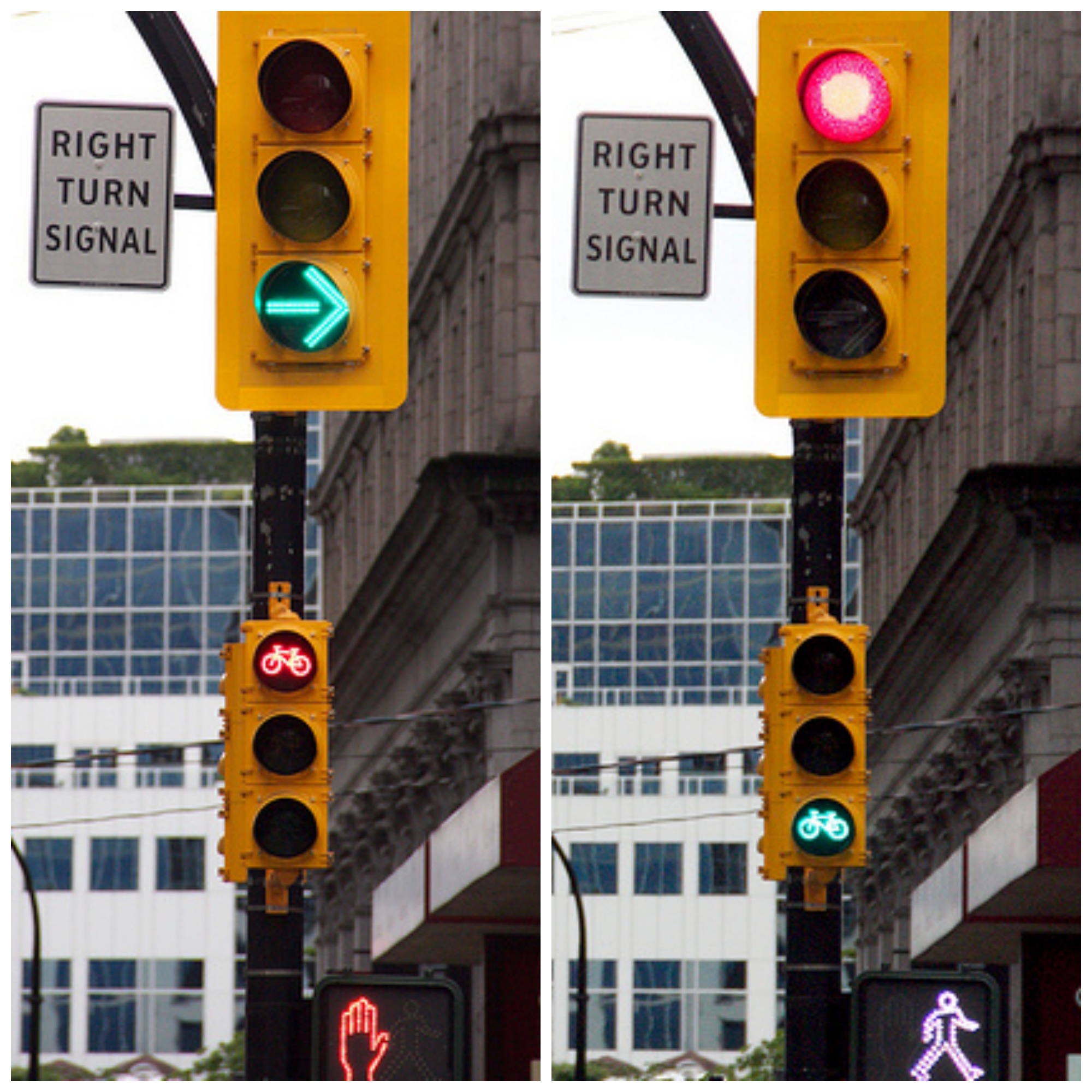
So then the next bike lane we did was Hornby. And our approach on Hornby took it a step further where in those lanes, we use signals to physically separate the movements. So vehicles sitting in that right lane also have a right turn signal that they have to wait for, and that signal holds the bikes and pedestrians. And then there’s a red light for the turning vehicles, there’s no right turn on red, and bikes and peds get to go.
The more signal phases you add to an intersection, the longer each person has to wait, so that seems like a hard tradeoff to make.
Absolutely. That’s why I’m the most hated man in the city.
You can’t create time, so it’s all about tradeoffs. Every time you add an additional movement, it has to take away time from the other movements.
We’re also considering scramble intersections, where you halt all vehicle traffic and allow pedestrians to travel in any of the directions, diagonals included. But that takes time from other movements. We actively wanted to include some scrambles and we analyzed dozens of intersections and we couldn’t find one where there would be a major improvement that would offset any of the disbenefits. We used to have scramble intersections in the seventies, and we took them out because of the congestion.
So, we were trying desperately to install one and through that analysis we found locations where a leading pedestrian interval could improve the safety and efficiency of the intersection.
I think DC only has one scramble. But the leading pedestrian interval is a huge help.
But again, there’s a learning curve there because people aren’t used to not getting the green immediately.
Have there been innovations since Hornby, or is that where you are now with intersection design?
There’s always innovation. The most recent separated bike lane is along Point Grey Road.
But I should step back a minute. Our Transportation 2040 plan has a couple of clear policies around cycling. Number one is that we need to design the system for All Ages and Abilities -- we call that Triple A. And the reason for that is, we know where our target market is to grow cycling, and our target market isn’t to design for confident cyclists. Our target market to grow cycling is to design for kids, seniors, people that are interested. We know that there’s 50-60 percent of our population that’s interested in cycling but they’re very concerned about safety and proximity to cars.
Did Vancouver do its own study on that? I know there’s a similar study out of Portland.
Yes, Kay Teschke at UBC did a study for Metro Vancouver that has similar results to Portland.
Kay Teschke’s work also analyzed what types of facilities people wanted to use. The first choice were paths in parks: beautiful green trees, birds singing, nowhere near anybody. But as you started to move into a more dense urban area, there were two clear choices: Either traffic-calm the vehicles so there’s a very low number of vehicles on the road and then I would be okay riding mixed with traffic. Or, if it’s on a road that has a large number of vehicles, then physical separation between the bikes and the cars.
Those were the two. If you want me to ride my bike, give me one of those two. So that’s exactly what our plan concluded.
We have a couple hundred kilometers of neighborhood bikeways through single-family or neighborhood streets, and we traffic-calm them to be below 1,000 vehicles a day, preferably under 500 a day. Then we’re okay with bikes mixing with cars. And if we can’t do that -- commercial areas, downtown, busy streets where we can’t drop the volume of vehicles significantly -- then it’s physical separation.
So for Point Grey Road -- a fairly long addition to the bike network -- there’s a combination of both. Most of the first section is in a commercial area on a busy road, so we provided a physical separation. Then we close the road, and so west of McDonald, we traffic-calmed to about 500 vehicles a day.
Kay also did an additional study on safety. She looked at a dozen or more different types of bike facilities and then at the safety on each of those. And I don’t know if it should be a surprise, but the types of infrastructure that people felt most confident using were the safest. Plain and simple. No surprises.
Now as we go forward, looking at projects, our first question is: What can we do with the street, how many vehicles are there today, can we traffic-calm it down and reduce it to a quiet neighborhood street? If the answer’s yes, then we do that. If it’s a bustling commercial area with either goods movement or transportation connections -- if you can’t drop the volume -- then it’s a separated bike route.
I imagine there are places where you can’t do either, that some of those bustling streets don’t have space on them.
That’s on our too-hard pile that we’re dealing with now. For example, as you come off the Burrard Bridge, Cornwall is a neat little commercial area about three blocks long. We put a separated bikeway for the first block, and we haven’t completed the next couple blocks -- and that’s exactly the issue there. It’s a very, very busy bus corridor; it’s a very busy commercial corridor; and the street right-of-way is quite narrow. So we haven’t tackled that.
So we provided two alternatives a block away that provide a long term connection -- one is a recreational route along the water, through and along parks at a slower speed, and the other is a block on the other side that is more of a commuter route, and we traffic-calmed the volumes on that neighborhood street.
Commercial Drive is also identified in our transportation plan, and we’ll be looking at that over the next couple years. Again, a very, very busy bus corridor; a very, very successful commercial area; very narrow right-of-way. So your choices are bikes, parking, buses, cars. We’ll be looking at that in the next couple years.
I should say our approach overall is to look at the areas where we have the highest potential for ridership so we’re getting the biggest bang for the buck. So we’re choosing routes not just on overall connectivity citywide -- it’s looking specifically at gaps in areas where we have high density, a lot of demand, origin-destination, good demographics for cycling so we get a good response right away.
I talked to people at DDOT recently and they were saying that for their long-range plan, it was similar. They’ve already done all the low-hanging fruit, all the easy stuff they can do without major tradeoffs. And the next things they’re going to do in terms of cycling infrastructure and transit infrastructure are going to be those harder choices. It sounds like you’re in a similar place.
Yeah, and I’m not sure it gets easier. I keep waiting for it to get a little easier. You’d think that as the infrastructure is in place and people get used to it -- as they start to have experiences with it -- some of the concerns they have about change and uncertainty, you’d think, would start to go, because they have facilities they can look at and have a little more certainty about what the “after” will be. But I haven’t seen that yet.
That wraps up our pre-conference buzz. Tune in next week for coverage of the Pro-Walk Pro-Bike Pro-Place conference itself -- or say hi to Payton and me in Pittsburgh!
Read More:
Stay in touch
Sign up for our free newsletter
More from Streetsblog USA
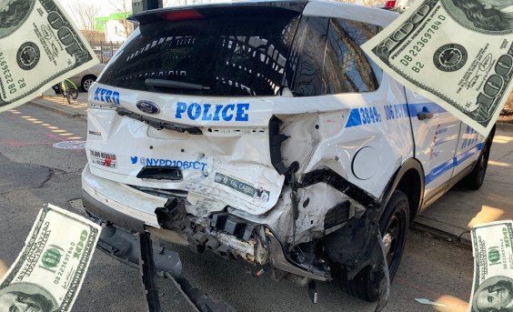
Car Crashes by City Workers Cost NYC Taxpayers $180M in Payouts Last Year: Report
A record number of victims of crashes involving city employees in city-owned cars filed claims in fiscal year 2023 — and settlements with victims have jumped 23 percent, a new report shows.
Tuesday’s Headlines Are Driving Inflation
Driving — specifically, the cost of car ownership — is one of the main factors behind inflation, according to the Eno Center for Transportation.
SEE IT: How Much (Or How Little) Driving is Going on in America’s Top Metros
Check it out: The lowest-mileage region isn't the one you'd think.
Monday’s Headlines Bring Another Setback
The Biden administration's new rule requiring states to report their greenhouse gas emissions from transportation was dealt another blow when the Senate voted to repeal it.
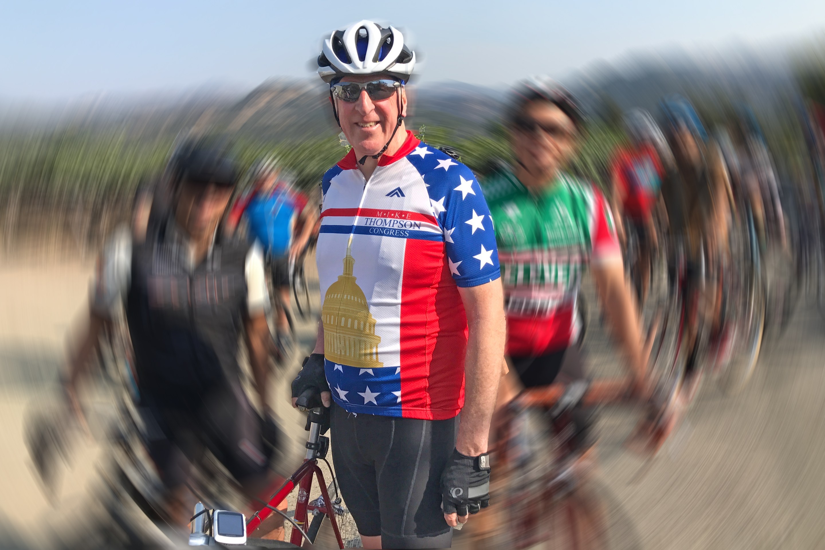
‘The Bike Is the Cure’: Meet New Congressional Bike Caucus Chair Mike Thompson
Meet the incoming co-chair of the congressional bike caucus — and learn more about how he's getting other legislators riding.