Louisville, Kentucky, is, by all accounts, a city with a lot of potential. An old river city, it has a wealth of beautiful, historic architecture. It's mid-sized, but large enough to have some good urban amenities. It's affordable, with a downtown waterfront and some unique cultural charms. As the New York Times said in its article about the city earlier this week, "Louisville has good bones."
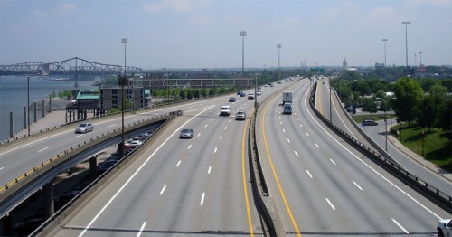
But, regrettably, Louisville seems to be on the verge of taking a giant step backward. Even back in the early 1960s, Jane Jacobs was warning that the "biggest threat" to a popular downtown shoe market was "an expressway that will cut diagonally across." That market, along with much of the downtown's pre-expressway vitality, is long since history. But the expressways live on.
Which is why the project to widen a nexus of highways and add a bridge between downtown and Indiana has been so controversial. The Times seemed perplexed about why Louisville -- a city whose director of economic growth and innovation would proudly proclaim “urbanism is the preferred lifestyle now” -- is expanding the downtown real estate it dedicates to highways, when so many other cities are choosing to remove them:
As for the notion that expanding the interstate tangle and adding the sister bridge next to the Kennedy might bring more people and jobs into the city, I can only say that 40 years after the interstates supposedly started pumping life into Louisville’s downtown, the streets here looked pretty empty, especially at night.
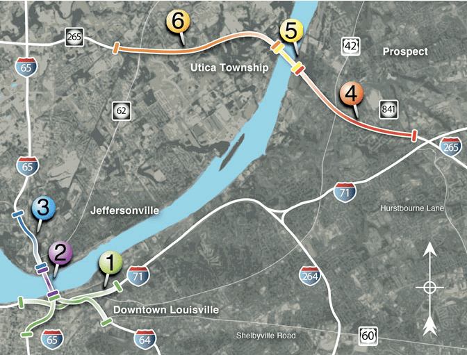
The $2.6 billion project, one of "the biggest transportation improvements in the nation" according to its proponents, is a combination bridge and highway widening plan that includes two bridges and four highway segments. We wrote about this project's other highway bridge segment -- the I-265 bridge, "Indiana's Big Dig," which lies several miles to the north -- in a previous story.
Why would Louisville do this? The answer, as noted by the NYT and local blogger Branden Klayko, is partly politics, partly business.
Louisville, home to the headquarters of UPS, considers itself a logistics city. A coalition of business leaders united under the banner "Building Bridges Coalition" is pushing hard for the highway project's completion.
"If you say anything against the highway you’re almost put on a blacklist," said Klayko. "It’s been difficult for people to speak against the project."
Nevertheless, an opposition group called the Coalition for the Advancement of Regional Transportation recently filed a lawsuit seeking to halt the project on civil rights and environmental grounds. A few years back, another group calling itself 8664 even put together a proposal to tear down the elevated portion of I-64 that runs between downtown and the Ohio River and replace it with a boulevard. For a while, that concept had enough traction that the Congress for New Urbanism added it to its Freeways without Futures list.
But any opposition was dealt a heavy blow when U.S. DOT gave the controversial $2.6 billion mega-project its blessing in early August. The states of Kentucky and Indiana, which are jointly financing the project, held a "ceremonial" groundbreaking late last month, tearing down a historic building in the new freeway's path.
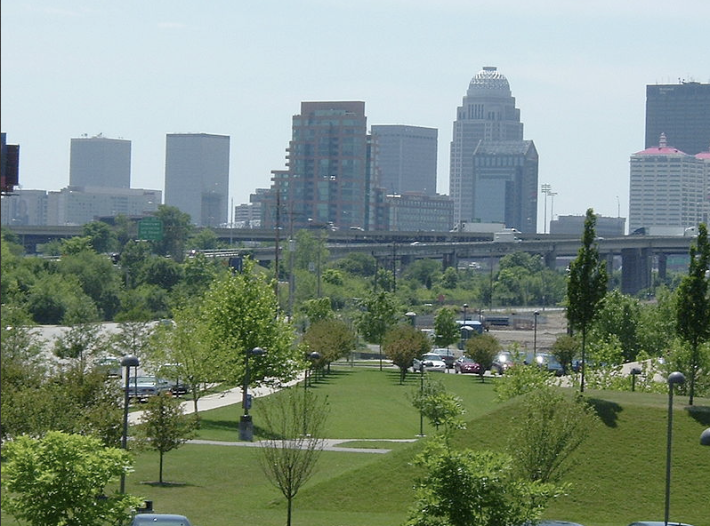
Klayko says at this point the project almost feels like a done deal. But he's still holding out hope something could change. What a lot of people don't realize, and what both project sponsors and opponents did a poor job communicating, was exactly how disruptive this new roadway will be to the downtown.
Interstate 65 "is going to be a 12-lane highway going through Main Street," said Klayko. "It will have eight full-size shoulders -- about 300 feet, plus or minus, of elevated highway. It’s almost a whole block."
The New York Times referred to an arts district that is coming together not far away from the highway's path, along East Market Street:
A renovated 19th-century former dry goods store, the Green Building, opened to much fanfare in 2008 and inspired a cluster of art galleries and upscale restaurants in an area long known for its homeless shelters and projects for the poor. The neighborhood now advertises itself as NuLu.
"We’ll see if 300 feet of highway is enough to kill it," said Klayko.

