7 Photos Show How Detroit Hollowed Out During the Highway Age
While searching for images of highway interchanges in urban areas, I came across these historic aerial photos of Detroit on a message board, showing how the city fabric has slowly eroded. It's a remarkable record of a process that has scarred many other American cities.
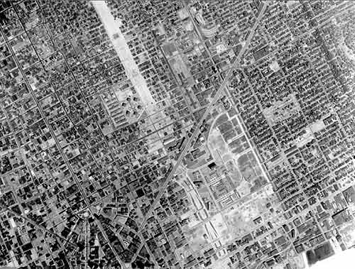
1949: Here's what the east side of the city looked like right at the middle of the century, with Gratiot Avenue forming the diagonal. Detroit was a big, bustling city.
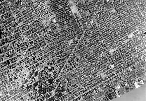
1952: Just a few years later though, urban renewal and other city-clearing initiatives were already leaving their mark.
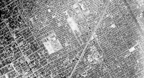
1961: Almost a decade later, you can see a large space south of Gratiot had been cleared to make way for Lafayette Park, a neighborhood of high-rise residential towers.
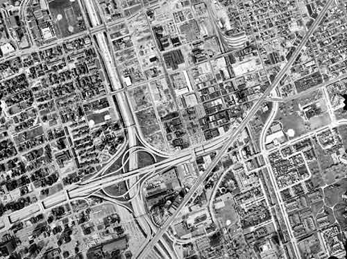
1967: By the mid-1960s, land was cleared and buildings destroyed to make way for Interstate 375.
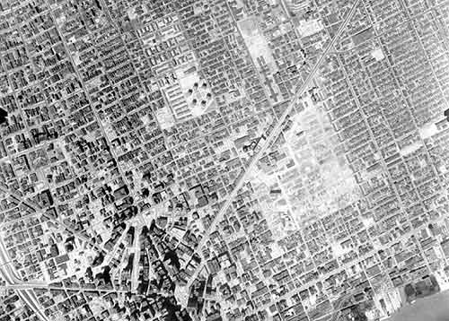
1981: The freeway is complete, along with a monster interchange. The tight network of small streets and small blocks has been replaced by mega blocks.
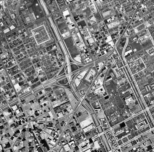
1997: By the turn of the century, the area is almost unrecognizable.
Finally, in this recent shot, you see that the new Tigers Stadium has entered the landscape, surrounded by a field of parking.
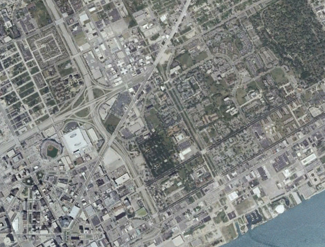
Can this process be reversed? Well, the city of Detroit is considering the removal of I-375, so there is hope.
Thanks to user GSGeorge at the forum AtDetroit.net for sharing the first five of these images. The originals up to 1997 -- and other aerial photographs from all over the city -- can be found in this image repository maintained by Wayne State University.
Stay in touch
Sign up for our free newsletter
More from Streetsblog USA
Thursday’s Headlines Don’t Like Riding on the Passenger Side
Can you take me to the store, and then the bank? I've got five dollars you can put in the tank.

Study: When Speed Limits Rise on Interstates, So Do Crash Hot Spots on Nearby Roads
Rising interstate speeds don't just make roads deadlier for people who drive on them — and local decision makers need to be prepared.

‘We Don’t Need These Highways’: Author Megan Kimble on Texas’ Ongoing Freeway Fights
...and what they have to teach other communities across America.
Should Wednesday’s Headlines 86 SUVs?
American tax law encourages people to buy the gas-guzzling and deadly vehicles, but some in Canada are pushing to ban them.

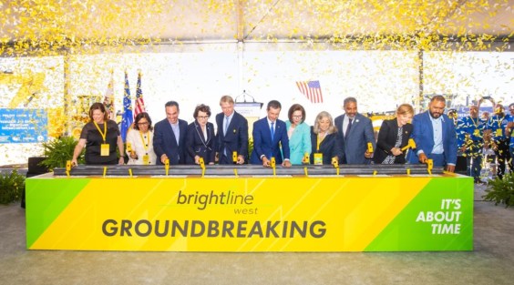
Brightline West Breaks Ground on Vegas to SoCal High-Speed Rail
Brightline West will be a 218-mile 186-mile-per-hour rail line from Vegas to Rancho Cucamonga — about 40 miles east of downtown L.A. — expected to open in 2028.