While searching for images of highway interchanges in urban areas, I came across these historic aerial photos of Detroit on a message board, showing how the city fabric has slowly eroded. It's a remarkable record of a process that has scarred many other American cities.
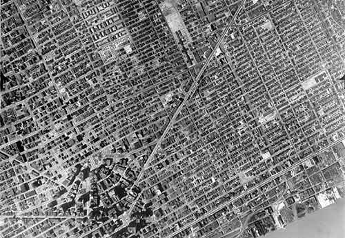
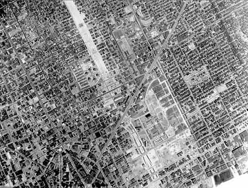
1949: Here's what the east side of the city looked like right at the middle of the century, with Gratiot Avenue forming the diagonal. Detroit was a big, bustling city.
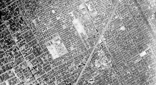
1952: Just a few years later though, urban renewal and other city-clearing initiatives were already leaving their mark.
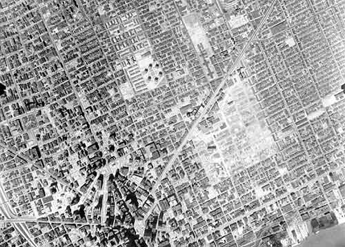
1961: Almost a decade later, you can see a large space south of Gratiot had been cleared to make way for Lafayette Park, a neighborhood of high-rise residential towers.
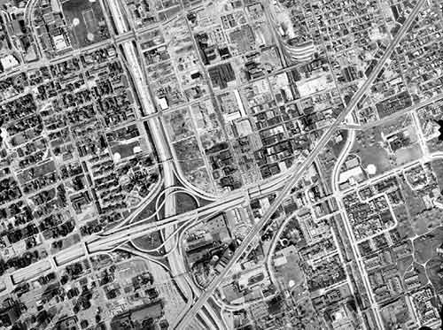
1967: By the mid-1960s, land was cleared and buildings destroyed to make way for Interstate 375.
1981: The freeway is complete, along with a monster interchange. The tight network of small streets and small blocks has been replaced by mega blocks.
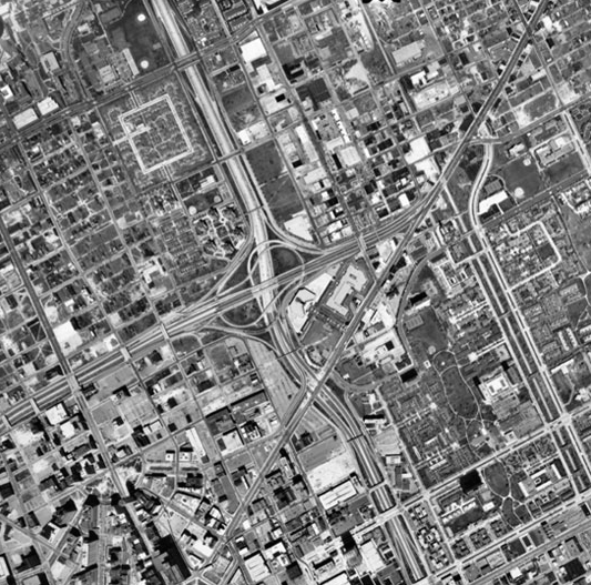
1997: By the turn of the century, the area is almost unrecognizable.
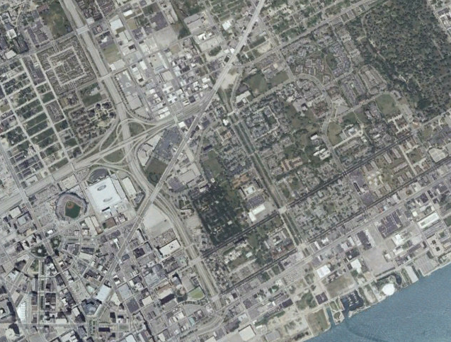
Finally, in this recent shot, you see that the new Tigers Stadium has entered the landscape, surrounded by a field of parking.
Can this process be reversed? Well, the city of Detroit is considering the removal of I-375, so there is hope.
Thanks to user GSGeorge at the forum AtDetroit.net for sharing the first five of these images. The originals up to 1997 -- and other aerial photographs from all over the city -- can be found in this image repository maintained by Wayne State University.