How a Transit App for the Blind Could Revolutionize How Everyone Rides
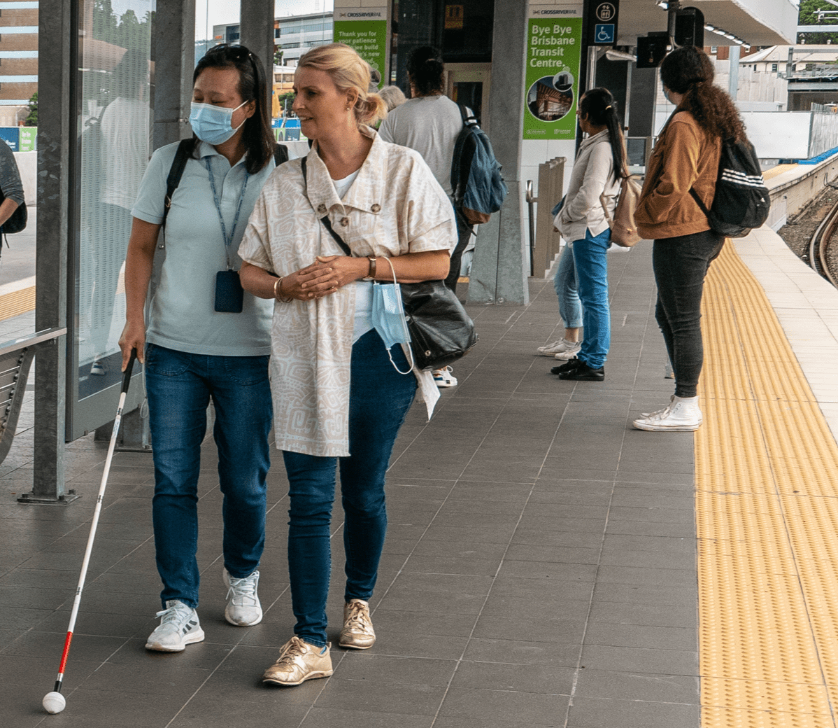
Photo: John Robert McPhereson, CC
A groundbreaking new technology aimed at making every inch of the transit network accessible to people with visual impairments could also help dismantle one of the steepest barriers that many Americans face when they first try to use a shared mode: navigating the labyrinthine underground landscapes that GPS can't reach. And it's coming to U.S. transit networks.
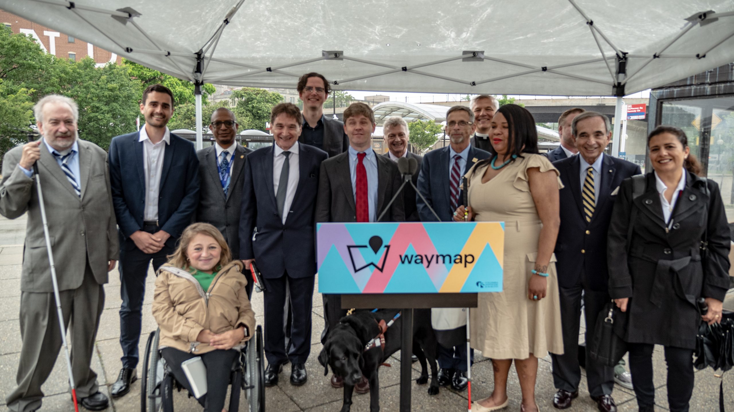
At a recent event, the Washington Metropolitan Area Transit Authority in D.C. announced that it would become the first in the U.S. to offer free, turn-by-turn audio directions throughout 25 of its most heavily utilized underground subway stations and over 1,000 bus stops, with the remaining stations to be mapped in mid-2023. The company behind the app, London-based navigation company Waymap, is also reportedly in talks with Los Angeles County Metropolitan Transportation Authority to bring a similar pilot there in the fall, and is receiving even more interest in Europe.
A phone-based way-finding service might seem like a modest improvement at first, but it represents a major technological breakthrough that will benefit anyone who's ever struggled to find the right train platform at an unfamiliar station — and it's an even more significant breakthrough for the blind community.
According to Waymap's research, people with low or no vision take 20 percent fewer journeys outside the home than their sighted counterparts, and that they stick to just 2.5 regular routes on average when they do go out, because it's simply too challenging to memorize all the complexities of a less-familiar path.
Waymap Founder Tom Pey, who lost his sight at age 39, says safe routes through transit facilities, in particular, have long been at the top of the blind community's wish list.
"About eight years ago, I asked a group of young people at the Royal Society for Blind Children what would change the world the most for them, and they said, 'Getting around the London Underground like everyone else,'” Pey said. "So I said, 'I want to solve that problem for you.'"
Available technology, though, wasn't yet up to the task, even as the proliferation of smartphones essentially put a precision tracking device into nearly every pocket. Though other apps have used Bluetooth to help blind riders use underground trains before, those systems rely on expensive networks of static beacons that can easily get damaged or vandalized, and the company once estimated it would take 10,000 of them to map the Underground's stations alone. Others require users to physically scan the area for nearby QR-style codes, and GPS services, of course, go dark the moment a rider goes subterranean.
"All that Google Maps does is get you to the front door of this underground labyrinth, and then it says, 'Good luck,'" said Celso Zuccollo, chief operating officer for the company. "When you’re unfamiliar with a city and you’re not comfortable with the environment, that might mean you don't ride the train at all."
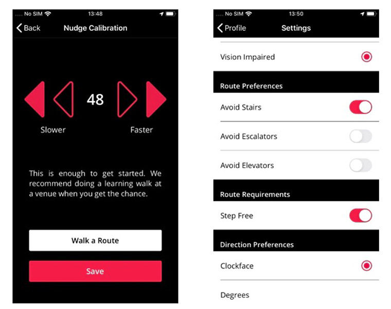
By utilizing the sensors already built into most modern cell phones to detect a user's movement, direction, and elevation — along with a bunch of bogglingly advanced algorithms and something called a "particle-filter-using probability theory and Bayesian statistics" — Waymap is able to locate a transit rider within just three feet of her actual location, tell her exactly when to turn to avoid an oncoming hazard like an open stairwell, and route her safely to her train platform, or a water fountain, or even a bench to rest.
When a large number of anonymized users are avoiding a recommended route — for instance, when an elevator is broken — Waymap's algorithms will adjust the paths of future users, not unlike a traffic congestion warning on Google Maps. In time, it may even be able to adjust for even more temporary hazards, like steering a rider away from a recently-mopped floor. And it does all this without compromising user privacy, since Waymap performs all of these calculations without ever needing to transmit information through cellular data or WiFi.
The app can even integrate transit vehicle arrival alerts — something that studies show actually makes riders feel less impatient as they wait — and is adjustable based on the users's specific stride length, mobility challenges, cognitive needs, and more. Zuccollo says that means it can be adapted to virtually anyone in the disability community — or anyone who just wants a little help finding their way.
"This is a really prime example of universal design," Zuccollo added. "It’s built first and foremost for people with visual impairments, but it also benefits people with other mobility impairments, with cognitive impairments like Azheimers, even the general public. A lot of people in the tech world talk about building the world for everyone, but they're really building for 99 percent of people. We want to build the world for 100 percent of people."
Indeed, one survey from the company recently found that 100 percent of participants in a London pilot said they would "be somewhat or much more likely to use public transportation if Waymap was available" after trying the app — essentially opening up an entire new potential niche of transit riders to agencies, while also potentially unlocking new levels of mobility and independence for the 26 percent of Americans that live with some form of disability.
Now that Waymap is on its way to being active across a major U.S. transit network, Pey is hopeful that more agencies will feel confident investing in providing its services to riders, which he says cost so little that they "hardly rate a budget line."
"I don’t think economics is the barrier," Pey added. "I think the barrier is simply, saying 'let’s get our heads around this problem. Let’s make our cities and our towns accessible for everyone, whether you’re a person who’s blind, a person who’s got a mobility challenge, a visitor, or someone who just wants to have a little support.'"
And once every transit station in America is mapped, the Waymap team is setting their sights on mapping every other internal space that people with visual impairments struggle to reach after their train carries them to their destination — and much like the curb cut effect, that will carry benefits for everyone. Think maps that can direct a user straight to the shelf in the grocery store with her favorite cereal, or to a specific work of art in a sprawling museum, or down the confusing corridors of a hospital to a loved one's bedside.
"It’s not just about the [transit stations]; it’s also the hotels, the sports stadia, the shopping centers." adds Zuccollo. "Our big, ambitious goal, someday, is to have Waymap everywhere."
Read More:
Stay in touch
Sign up for our free newsletter
More from Streetsblog USA
Thursday’s Headlines Don’t Like Riding on the Passenger Side
Can you take me to the store, and then the bank? I've got five dollars you can put in the tank.

Study: When Speed Limits Rise on Interstates, So Do Crash Hot Spots on Nearby Roads
Rising interstate speeds don't just make roads deadlier for people who drive on them — and local decision makers need to be prepared.

‘We Don’t Need These Highways’: Author Megan Kimble on Texas’ Ongoing Freeway Fights
...and what they have to teach other communities across America.
Should Wednesday’s Headlines 86 SUVs?
American tax law encourages people to buy the gas-guzzling and deadly vehicles, but some in Canada are pushing to ban them.

Brightline West Breaks Ground on Vegas to SoCal High-Speed Rail
Brightline West will be a 218-mile 186-mile-per-hour rail line from Vegas to Rancho Cucamonga — about 40 miles east of downtown L.A. — expected to open in 2028.