This week, Fritz Steiner of the Stuart Weitzman School of Design, University of Pennsylvania Professor Emeritus Bob Yaro, and University of Texas Professor Ming Zhang talk about their new book, "Megaregions and America’s Future."
For those of you who get your news through your eyes and not your ears, there’s an edited transcript below the audio player. For an unedited transcript, click here.
Jeff Wood: What specifically is a megaregion, like what constitutes the geography that you all put together as defining what the megaregion is and what it might be?
Fritz Steiner: Well, the short answer is that it’s more than two metropolitan regions that are growing together. The classic megaregion in the United States is the northeast megaregion from Boston to south of Washington, D.C.... Bob can pick up the story; he started to observe, when he was teaching a studio here looking at the future of the United States, that there was an agglomeration of metropolitan areas ... beside the Northeast.
Bob Yaro: In partnership with Armando Carbonell at the Lincoln Institute [of Land Policy], and Jonathan Barnett, who was a practicing professor at Penn, I convened a studio called the "Plan for America" studio. Basically, I’d been doing some work at RPA at OECD in Paris, where I was rubbing elbows with our European counterparts, who were thinking at the scale. A group of academics from several European countries were working on an EU-funded project to look at the big systems — transportation, economic, environmental, and other systems — that were functioning at the continental scale in Europe, at what we would now call the megaregion scale. They identified several of these places in Europe and a few other things that just happened.
I finished the third regional plan in 1996 at RPA. We were beginning to think about how what we were doing could fit into a larger Northeastern scale and so forth. The Census Bureau in about 1997 or '98, came out with forecasts suggesting that the country was going to add something like 50 percent of its population by the middle of the century. And the question was, well, where are we going to put these people and how are we going to accommodate this growth? So we convened this studio and did some long-range land-use-change, population and economic forecasts. And you know what we began to see when we looked at the maps? Expanding metros across the country was the emergence of what we now call megaregions. At first we called them supercities.
Maybe that’s what they were. They were networks of cities that were beginning to function together. Armando Carbonell felt that, given the anti-urban bias throughout American history, we ought to come up with a term that wasn’t inflammatory. So that’s where Armando suggested the "megaregion" terminology, which has stuck. It was interesting. ... I started looking at these maps that the students prepared. We were in London with Sir Peter Hall, who hosted the studio that year, and with a group of Andreas Faludi from the Technical University at Delft and Vincent Goodstadt from the Royal Town Planning Institute and others experts. I started looking at these maps over time — the suburbs of Philly really have really grown into the suburbs of New York in Mercer county, New Jersey, around Trenton, and similarly the suburbs of Raleigh-Durham and Atlanta and Birmingham and the other megaregions, Texas triangle — same thing, Austin, Dallas, Fort Worth Houston.
The suburbs were starting to grow together and it triggered, you know, our thinking that, well, there must be something more going on here. We started to do research on the interactions economically and in terms of natural systems and so forth in these places, and found that in fact, there was a significant amount of interaction. There were real advantages to these places. We also did work a series of studios at Penn; UT joined us on a few of them, where I think Fritz and Ming got involved. Starting in 2005 or '06, we started doing those.
Steiner: Yeah, Ming and I but also Kent Butler.
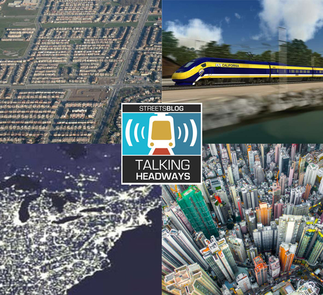
Yaro:... So we started bringing together scholars who saw the same trends emerging in all of these places, started seeing in economist terms, agglomeration economies, that were starting to see serious economic benefits coming out of both potential and existing collaborations. The other thing we learned from the Europeans and the Asians was that the mode of choice in megaregions around the world is high-speed rail, particularly in a country where the interstate-highway system has become very congested and has become increasingly inefficient as a means of moving passengers and goods.
So we needed to create improved transportation links between these places. What we learned from research on European and Japanese and Chinese and Korean high-speed rail, and others was that there was a sweet spot between something like 300 and 700 to 800 miles, in which high-speed rail was hands-down a winner compared with commercial aviation and with highway access. It raised the question: Why was the U.S. one of the few industrialized countries that didn’t have high-speed rail? A big part of the research program was in how high-speed rail could be advanced in this country.
One other thing, after the Penn Studio: We convened a number of these scholars from around the country and around the world at a round table at the Rockefeller Brothers Conference Center in New York. Out of that came a collaboration between Regional Plan and Penn and Lincoln called America 2050; that was a multi-year exercise to look at long-range population, economic, land-use and environmental trends in this country and how they could be managed. That furthered a lot of the research that we were doing at Penn and at the other institutions across the country, and a lot of the international collaborations,
Steiner: In addition to the transportation planning advantages of Megaregions, we also saw pretty quickly that there were an environmental advantages, which are really important given climate change. So air and water are big systems. Looking at the megaregion scale, if you’re going to do something like climate reserves, because of the heating planet, the mega-regional scale is very helpful in figuring that kind of thing out.