Photographic Proof That America Can Make Streets for People Instead of Cars
Need some inspiration to make your city's streets safer and more inviting?
Here's a good place to start: URB-I, a collective of urban designers based in São Paulo, has been collecting before and after images of street transformations using Google Street View's time lapse feature. The stockpile has grown to include 1,000 places around the world, including 107 in the United States. Below we've curated a selection of street redesign porn from URB-I's library.
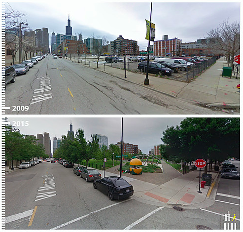
Like this one from Chicago -- a parking crater by W Monroe Street transformed into a park:
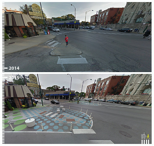
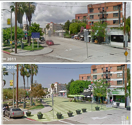
Also from Chicago -- painted sidewalk extensions made the "Lincoln Hub," a six-pointed intersection, safer for pedestrians:
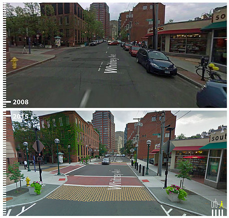
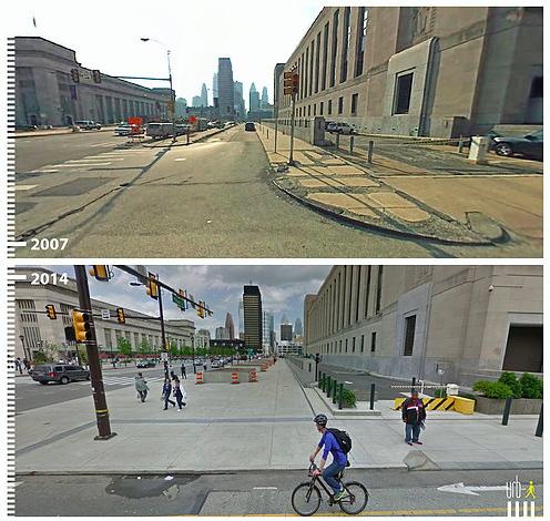
A major expansion of pedestrian space on Market Street in Philly:
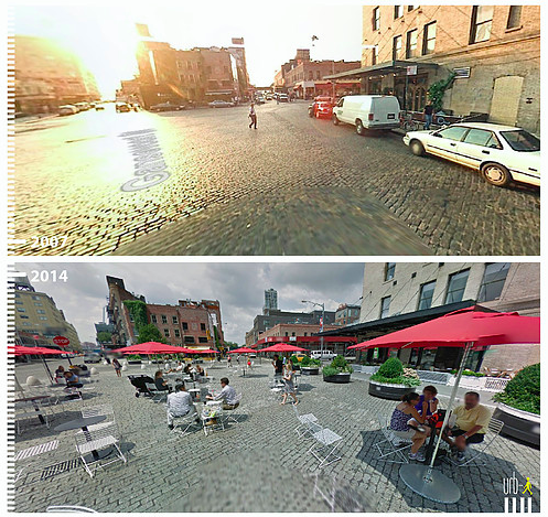
What a difference some tables, chairs, planters, and bollards make by Gansevoort Street in Manhattan:
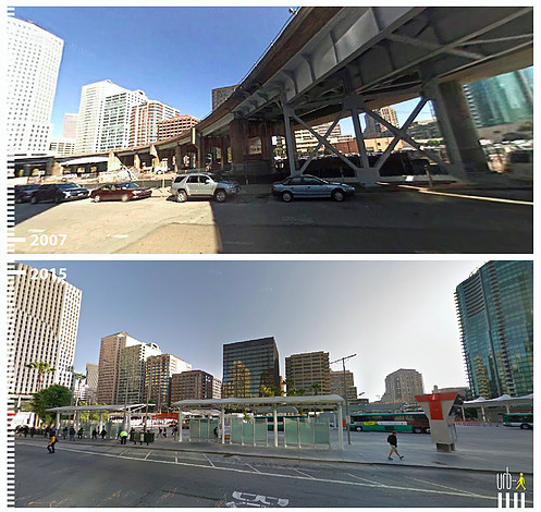
Here's the area around Beale Street in San Francisco with and without an elevated road:
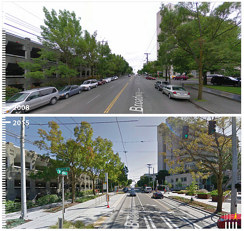
More space for walking, less for cars on Broadway in Seattle:
A new public plaza by Griffith Park Boulevard in Los Angeles:
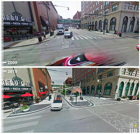
It's not just coastal cities on URB-I's map -- here's a pedestrian-friendly overhaul of Indianapolis's West Georgia Street:
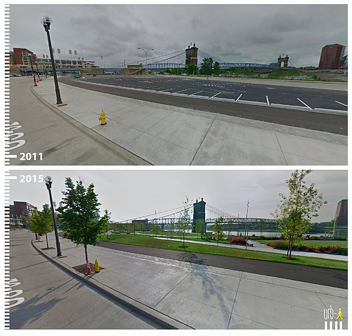
Another parking crater transformation -- the Ohio River Scenic Byway on the Cincinnati waterfront.
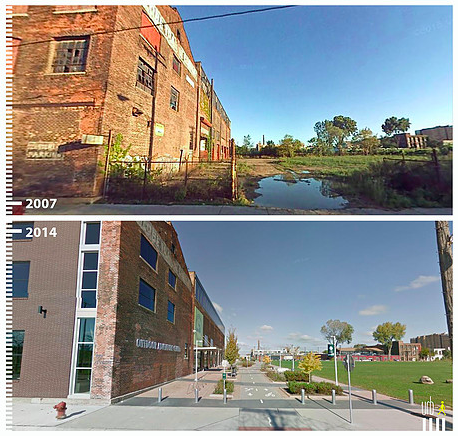
And here's the Detroit Riverwalk by Atwater Street:
This collection barely scratches the surface of what you can find in URB-I's catalogue, which includes hundreds of international examples.
Stay in touch
Sign up for our free newsletter
More from Streetsblog USA
Wednesday’s Headlines Are Running on Empty
Fewer commutes to downtown offices means less money to fund transit services, even as money for autocentric infrastructure keeps right on flowing.
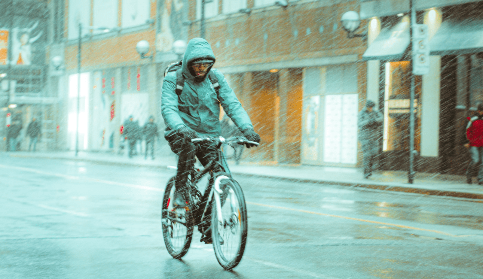
What to Say When Someone Claims ‘No One Bikes or Walks in Bad Weather’
Yes, sustainable modes are more vulnerable to bad weather. But that's why we should invest more in them — not less.
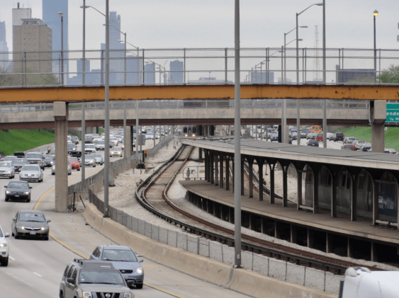
Chicago Announces $2M Federal Grant to Address Harms Caused By I-290
The Mayor's Office says the money will fund "improvements for people walking and bicycling on existing streets and paths surrounding and crossing the corridor."
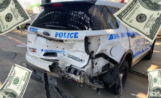
Car Crashes by City Workers Cost NYC Taxpayers $180M in Payouts Last Year: Report
A record number of victims of crashes involving city employees in city-owned cars filed claims in fiscal year 2023 — and settlements with victims have jumped 23 percent, a new report shows.
Tuesday’s Headlines Are Driving Inflation
Driving — specifically, the cost of car ownership — is one of the main factors behind inflation, according to the Eno Center for Transportation.