New Equity Atlas Tells a Story About the Future of Denver (With Maps!)
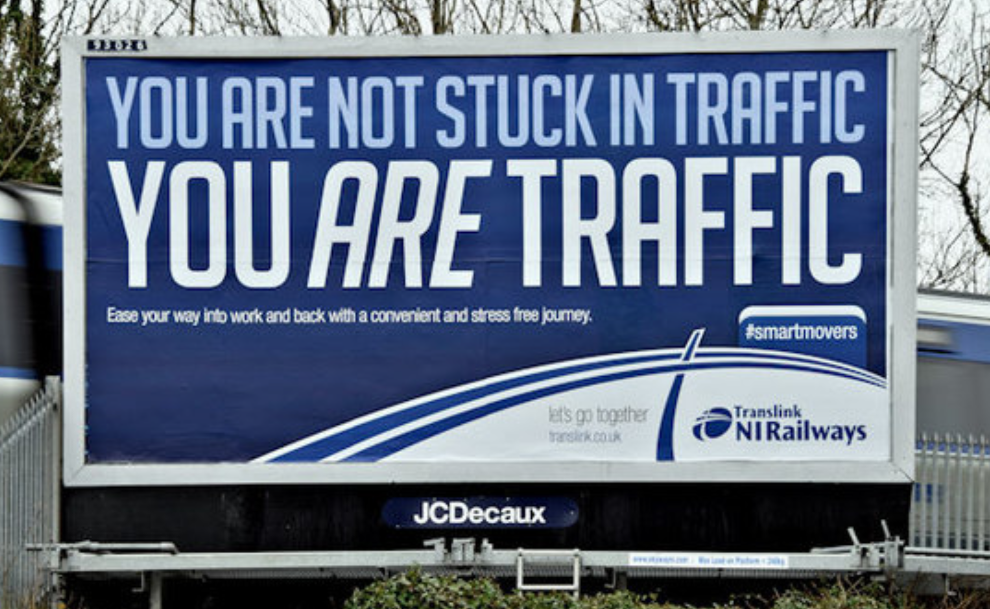
As more cities look to revive or expand their transit networks in the face of rising gas prices and maddening congestion, planners have had to remain vigilant to ensure that underprivileged communities are not displaced or adversely affected by the same transit improvements that could offer them numerous benefits.
A few different techniques have emerged that could assist planners and policymakers in making sure the benefits of transit are equitably distributed. Just last January, for instance, Streetsblog reported on the Health Impact Assessment for St. Paul, Minnesota's Central Corridor, which analyzed how a proposed light rail line could better serve disadvantaged areas along the route from a public health standpoint.
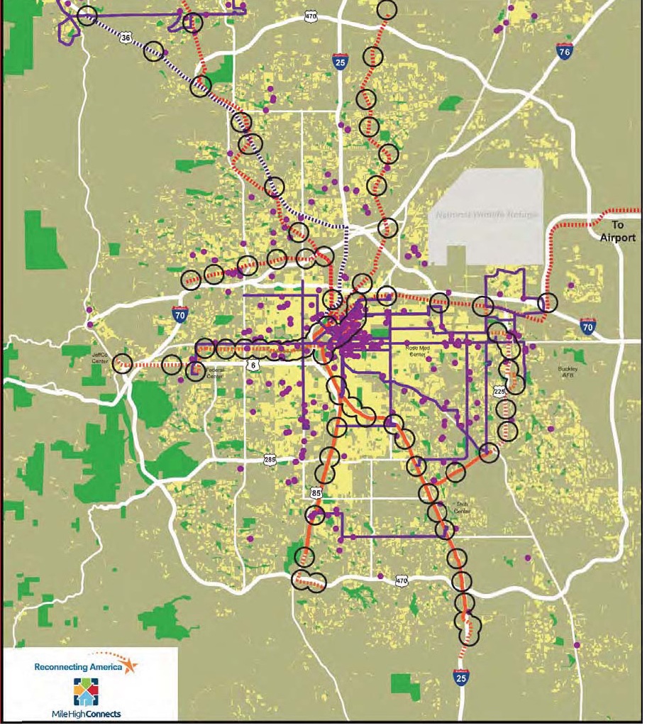
Last month in Denver, the national nonprofit Reconnecting America debuted the Regional Equity Atlas, a geographic encyclopedia of the Mile High City's ambitious long-range transit plans -- known collectively as FasTracks -- and the anticipated effects on surrounding communities. The report, a project of the Mile High Connects coalition, is a visual compendium of how the proposed transit expansions will affect not just health but housing, education, and economic development in greater Denver.
"It should be immensely useful not only to city officials, advocates, planners and social scientists in Denver, but also to anyone looking for a state-of-the-art analytical model to assist the coordination of transportation, housing, jobs, and access to important services in other American cities," Kaid Benfield, director of sustainable communities for the Natural Resources Defense Council, wrote last week. "It must have cost a fortune to underwrite."
The impetus behind the Atlas, starting with the formation of Mile High Connects some 18 months ago, was the decision by the Ford Foundation to invest in Denver, said Catherine Cox Blair, Program Director at Reconnecting America.
"We have strong local foundations in Denver who came to the table," including the Piton Foundation, which specializes in educational issues and is a co-author of the Atlas, Blair told Streetsblog. "Ford urged them to answer the question, 'You are building this massive transit system, but how do your giving priorities align to support FasTracks? How can you augment access and opportunity for everyone?'"
The first step in making sure access and opportunity could be equitably distributed would be to make sure all stakeholders knew how their diverse range of issues -- senior mobility, public health, education -- connected to transportation. And the best way to do that turned out to be with maps.
"Nobody has really thought about this spatially before," project manager Bill Sadler told Streetsblog. "People know the neighborhoods, they know where hospitals and grocery stores are, but they've never seen on a map, how far away things are or how close they are. That's the biggest reaction." Once the different partner organizations saw how they interacted with the transportation network, Sadler helped whittle their data down to 31 maps (still a big number, according to Sadler) that told the story of what transit means for all of Denver.
Partner foundations can use this information in countless ways. As Benfield pointed out on his blog, one point that comes through loud and clear is that the supply of affordable housing is larger than most people might realize -- but not all of it is close enough to transit. A local foundation, in reviewing community development grant applications, could adjust their priorities to support more initiatives that promote pedestrian and bicycle connectivity at transit stations, based on what they can learn by looking at a few maps in the atlas. At the same time, foundations dealing with public health could develop more accurate ideas of the catchment areas of different clinics and hospitals to guide them in their own grantmaking. All of a sudden, community groups with diverse interests and priorities are all looking at the same map to gauge their progress.
The Equity Atlas represents one full year's work for Sadler and his team, and through that work they have already identified their next area for research. "We have a jobs piece underway, drilling down into the jobs maps and looking at middle-skill jobs and small businesses in two corridors, so we can figure out how to connect people to those jobs, to where the training centers are, and make a stronger equity case within the economic development sector," said Sadler. "It's our goal within the collaborative to hold ourselves accountable as we build out our network. We want to look back in 5 or 10 years and see we've improved the quality of life for people in the region."
As for being a model for other cities to follow? "We got the idea from Portland," Sadler readily admits, referring to the Coalition for a Livable Future's equity atlas project, started in 2002. "I'd love to see it become a national model. There's still a lot of case-making to be made."
Stay in touch
Sign up for our free newsletter
More from Streetsblog USA
Tuesday’s Headlines Fix It First
How voters incentivize politicians to ignore infrastructure upkeep. Plus, are hydrogen trains the future of rail or a shiny distraction?

Why We Can’t End Violence on Transit With More Police
Are more cops the answer to violence against transit workers, or is it only driving societal tensions that make attacks more frequent?

Justice Dept., Citing Streetsblog Reporting, Threatens to Sue NYPD Over Cops’ Sidewalk Parking
The city is now facing a major civil rights suit from the Biden Administration if it doesn't eliminate illegal parking by cops and other city workers.
Five Car Culture Euphemisms We Need To Stop Using
How does everyday language hide the real impact of building a world that functionally requires everyone to drive?