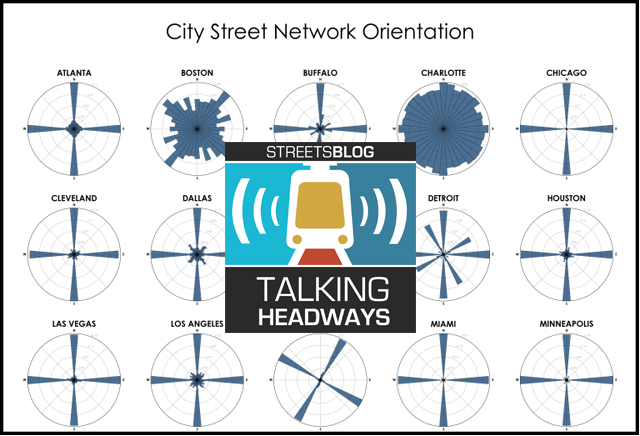
This week, we're going to try something new with our Talking Headways podcast: In addition to the embedded player, we're going to offer highlights of the conversation for those readers who prefer to get their news through their eyes instead of their ears.
This week, we’re chatting with Geoff Boeing, a professor of Urban Planning and Spatial Analysis at the Sol Price School of Public Policy at USC. Boeing talks all things data and streets, focusing first on data usage, moving on to street network design, and then to urban design. Here are some highlights:
Jeff Wood: You wrote about how data portals like Zillow or Craigslist are not really representative of the overall market. How is that? How can that be if data is so perfect and representative?
Geoff Boeing: Yeah, go figure. Yeah. So for the rental market a lot of the reason why we don't have really good up-to-date data about current rents and current asking rents is because those market behaviors aren't necessarily being captured and logged. They're often informal transactions between a landlord and a renter, either a landlord from a large building or even just someone renting out a granny flat behind their house or an upstairs room and in their home because of that inherent informality to a lot of the rental market we tend to not have good data exhaust, producing the sort of transaction trail that we can use keep track of what's happened and when, and put some numbers to it.
So a lot of the work that I have done in the past few years has collected rental listings from platforms like Craigslist to try to understand who is posting. What and what do those acting rents look like. Now the caveat is for rental listings, they are asking rents not final consummated transacted rents. So they're just a proxy for the latter. And they could be biased up or down depending on market conditions and how negotiations would work in that context, but they do tell us something about current asking rents on the open market.
Now the problem is that it is a biased data set. So what that means is that on Craigslist, we don't have a representative sample of all of the rental units in a city. So in most cities we tend to see this fairly strong over-representation of whiter, wealthier, and better educated neighborhoods. Those are the kinds of places where we tend to see more rental listings relative to the number of vacant rental units and then conversely in black or Hispanic neighborhoods, poorer neighborhoods or neighborhoods with lower educational attainment.
We have these sort of blind spots where we can't see as much information about them because [some areas] don't participate in these online exchanges. Now this is a common problem that plagues most volunteered geographic information or user-generated spatial data where different people will self select into the platforms. ... So if there are a bunch of housing listings available in the kinds of neighborhoods that my demographic profile tends to look at, I'm more likely to continue using it then someone else who can't find relevant information and their neighborhood or a neighbor. You get these sort of longstanding entrenched socio-spatial biases being reproduced in online platforms through these various processes of discrimination outright prejudice and even just simple self-selection.
Jeff Wood: Some of the findings that you had in your histograms specifically got really popular. Were you surprised at the kind of the viral sensation of it all?
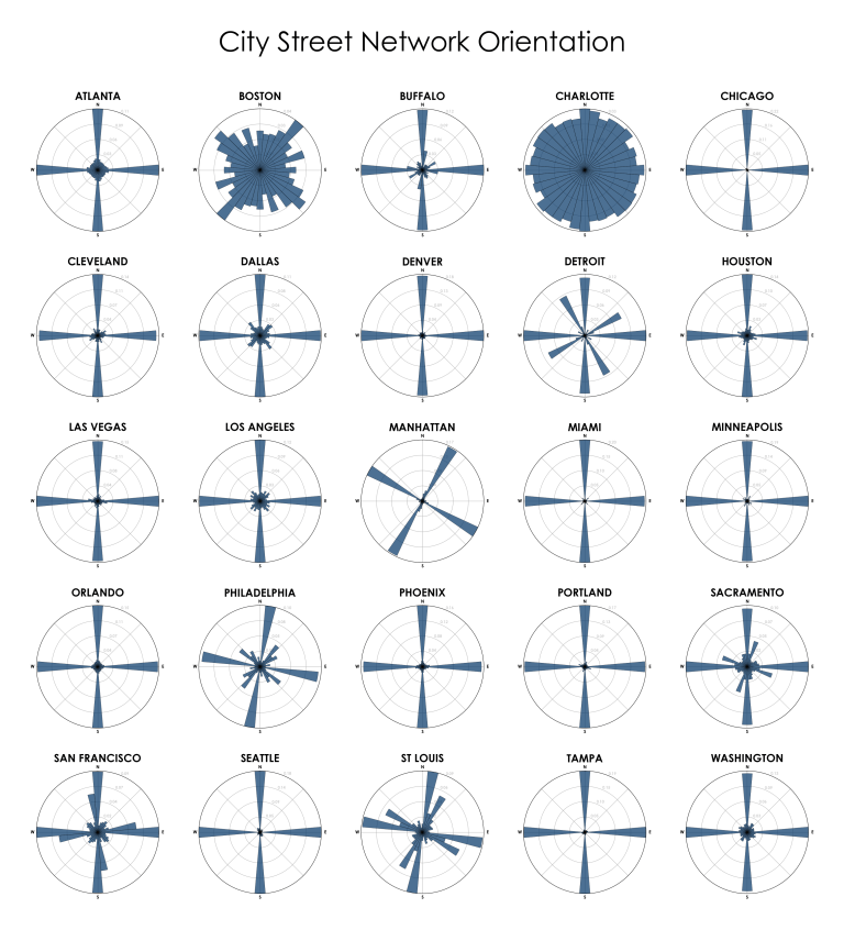
Geoff Boeing: Yeah somewhat. I mean, when I was doing it, I put it online because it was I thought it was a really nice visual content, you know, it looked pretty and it told an interesting story. But it's always kind of surprising what people get excited about. For those histograms, for example, they don't really tell tell a clear policy story or a planning story. There's nothing that really actionable from it. There's no causal model there that allows us to build better cities. They just help us understand what patterns already exist.
I think what was popular about it from at least from what people were telling me is that it compressed a lot of information about the city that we can all kind of put our thumb on from living in these different places into a really simplified artifact. So when you look at Manhattan, for example, you can trace the pattern of its grid offset from True North. When you look at a place like Detroit, you can see it's two offset grids one closer to the river and one kind of surrounding it and I think people who had some experience in these different places were really able to kind of track their own knowledge of the place and unpack some of those urban planning histories is that produce these different sort of patterns over time.
Chicago (top right corner) is the most perfectly gridded and Charlotte (just to the left of that) is the most disordered.
Read More:
Stay in touch
Sign up for our free newsletter
More from Streetsblog USA
Friday’s Headlines Got Served
Another day, another GOP lawsuit trying to overturn a Biden administration climate change rule.

Disabled People Are Dying in America’s Crosswalks — But We’re Not Counting Them
The data on traffic fatalities and injuries doesn’t account for their needs or even count them. Better data would enable better solutions.

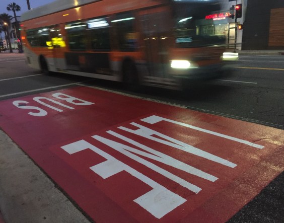
LA: Automated Enforcement Coming Soon to a Bus Lane Near You
Metro is already installing on-bus cameras. Soon comes testing, outreach, then warning tickets. Wilshire/5th/6th and La Brea will be the first bus routes in the bus lane enforcement program.
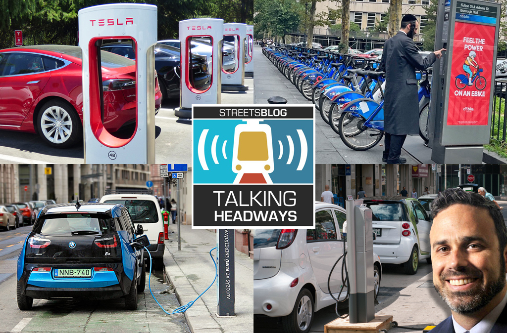
Talking Headways Podcast: Charging Up Transportation
This week, we talk to the great Gabe Klein, executive director of President Biden's Joint Office of Energy and Transportation (and a former Streetsblog board member), about curbside electrification.
Why Does the Vision Zero Movement Stop At the Edge of the Road?
U.S. car crash deaths are nearly 10 percent higher if you count collisions that happen just outside the right of way. So why don't off-road deaths get more air time among advocates?