A Haunting Glimpse at How Detroit Gave Way to Asphalt and Cars
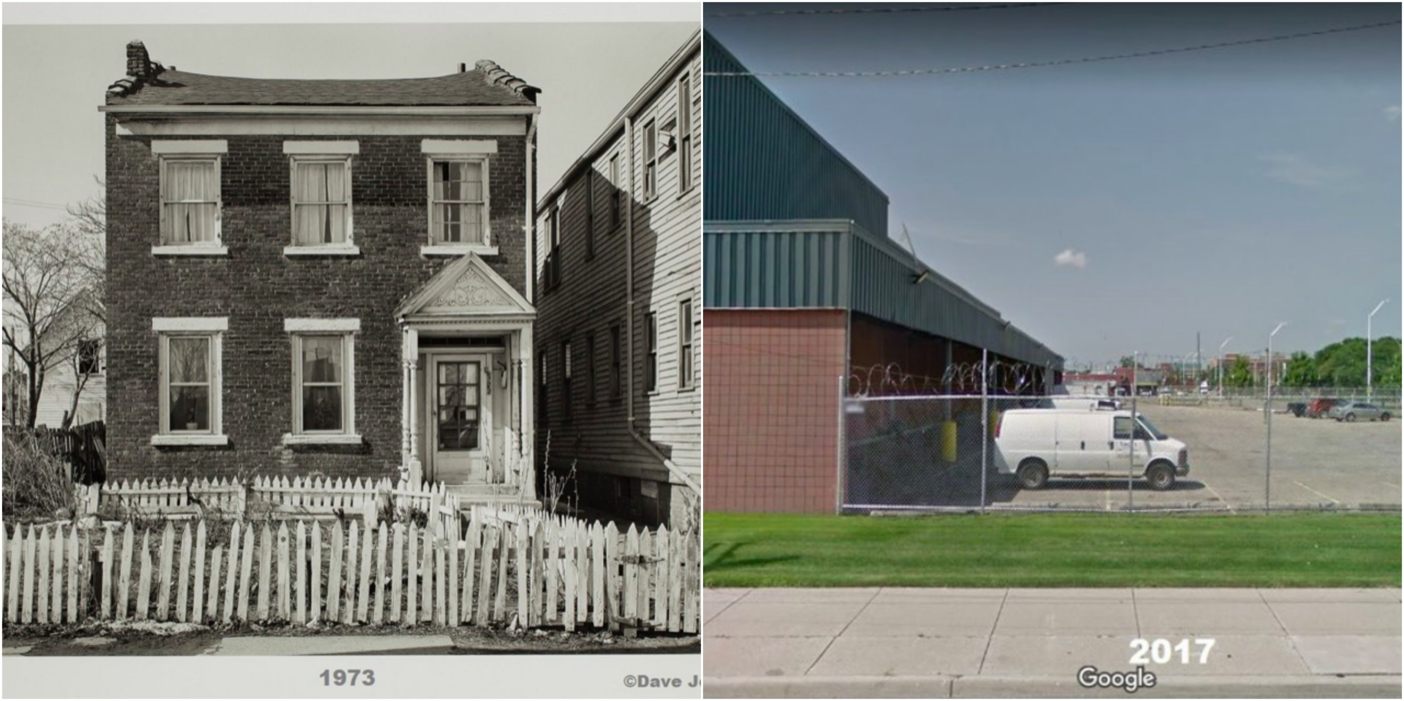
A historic house used to sit at 3539 Russell Street, which is now a distribution center. Before photo: Dave Jordano; comparison via Detroit Street View
These before and after photos of Detroit, compiled by Detroit Street View on Twitter, capture how the mass motoring era hollowed out American cities.
Detroit may have changed more than most urban places, but it was subject to the same forces as other cities -- white flight and suburbanization facilitated by car infrastructure, the loss and dispersal of manufacturing jobs, migration to the Sunbelt. These haunting images portray a transformation that happened all over the country.
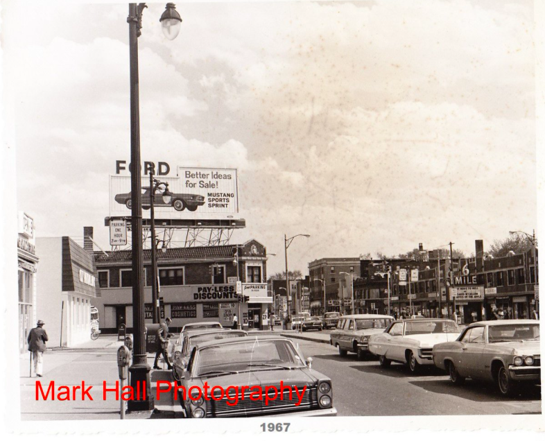
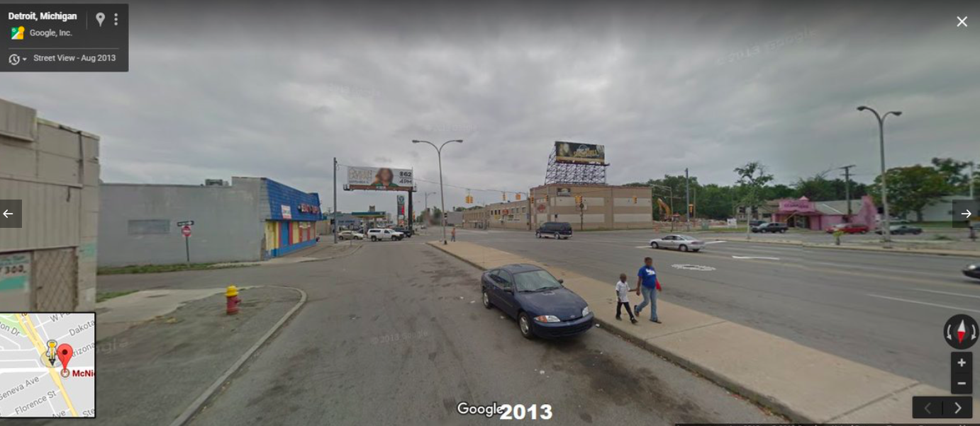
It's barely recognizable, but the blue building on the left corresponds with the white building on the left in the top photo. Since the 1960s, asphalt to carry car traffic has swallowed up the buildings and businesses that made this area walkable.
Here's one that captures the city in an in-between phase. In 1975, elevated highways had arrived, but people like the residents of this well-kept little house still persevered:
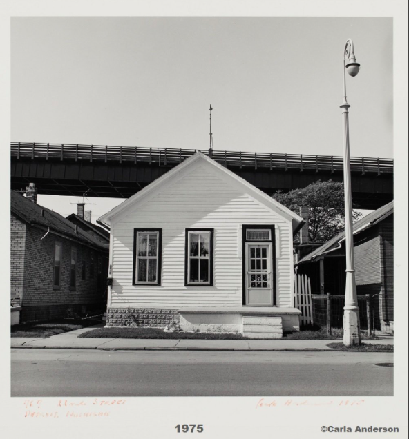
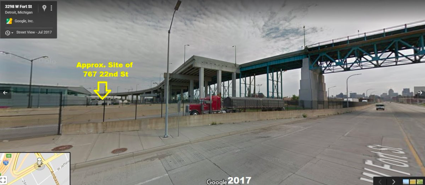
Today, that house is gone. This section of 22nd Street was removed to widen the Ambassador Bridge to Canada in the late 2000s, a project that has met with a barrage of legal challenges.
Here's a shot of a more central neighborhood, already looking neglected in 1980.
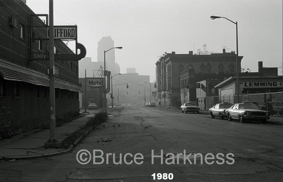
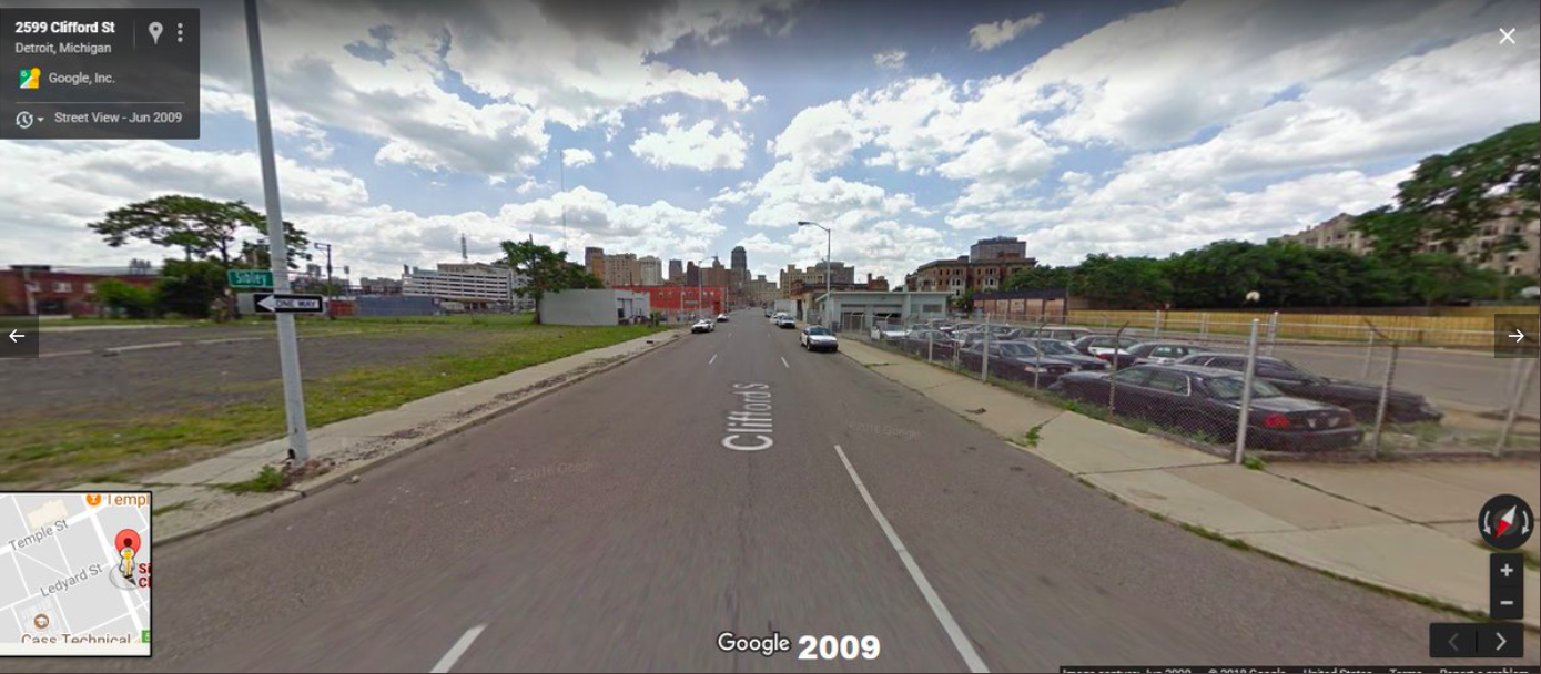
The corner retail in the foreground of the before photo, at Clifford and Sibley Street, was removed to make way for the Detroit Redwings arena and a parking garage, according to Detroit Street View.
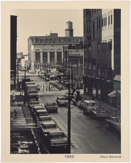
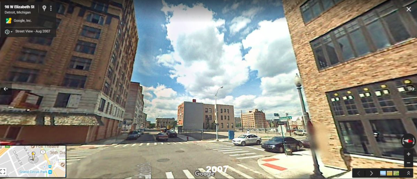
These photos show Elizabeth Street in Downtown Detroit. The large brick building in the foreground on the right was demolished in the 1970s after a long period of vacancy.
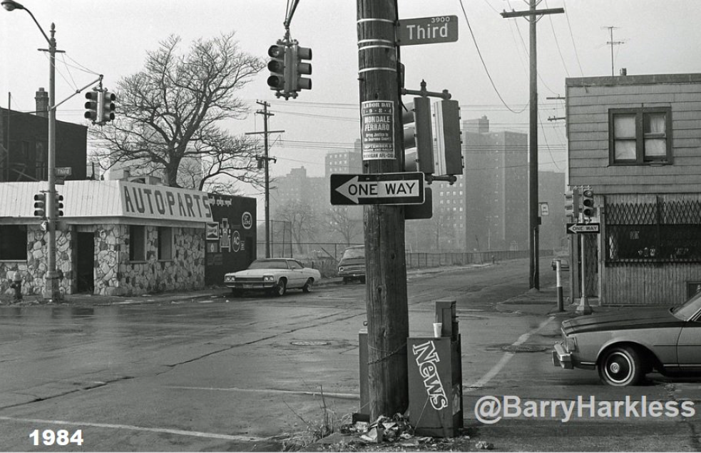
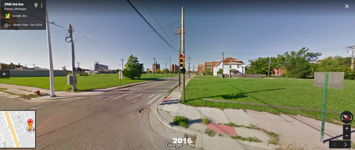
In the background of the photo below, of 3rd & Selden, you can see the Jeffries Homes, public housing built in 1953. It was demolished in 2001 and replaced with low-rise housing.
These photos capture Detroit at various stages in the cycle of disinvestment. As urban land values become lower, facilitated by highway sprawl and plant closures, more and more space becomes vacant or devoted to low-value uses like parking.
Obviously, if Detroit's economic fortunes had been different, the city would look a lot different today. But with few exceptions, every U.S. city has succumbed to this same pattern, albeit less dramatically.
Thanks to Detroit Street View for helping us see clearly what has been lost.
Read More:
Stay in touch
Sign up for our free newsletter
More from Streetsblog USA
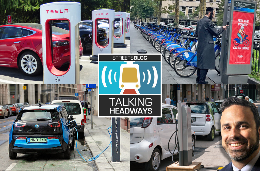
Talking Headways Podcast: Charging Up Transportation
This week, we talk to the great Gabe Klein, executive director of President Biden's Joint Office of Energy and Transportation (and a former Streetsblog board member), about curbside electrification.
Why Does the Vision Zero Movement Stop At the Edge of the Road?
U.S. car crash deaths are nearly 10 percent higher if you count collisions that happen just outside the right of way. So why don't off-road deaths get more air time among advocates?
Donald Shoup: Here’s a Parking Policy That Works for the People
Free parking has a veneer of equality, but it is unfair. Here's a proposal from America's leading parking academic that could make it more equitable.
Thursday’s Headlines Turn Up the Heat
Whether you realize it or not, climate change is here, and not just in the form of natural disasters.

Calif. Legislators Tackle AV, School Zone Safety
Are AVs freight trucks ready to be deployed on California roads with no one in them?