7 Photos Show How Detroit Hollowed Out During the Highway Age
While searching for images of highway interchanges in urban areas, I came across these historic aerial photos of Detroit on a message board, showing how the city fabric has slowly eroded. It's a remarkable record of a process that has scarred many other American cities.
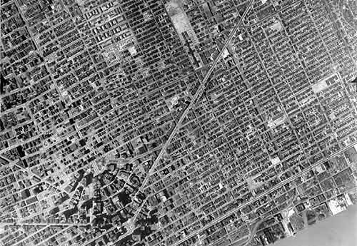
1949: Here's what the east side of the city looked like right at the middle of the century, with Gratiot Avenue forming the diagonal. Detroit was a big, bustling city.
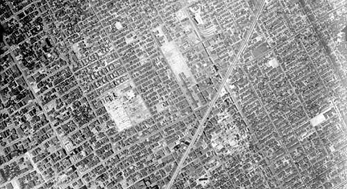
1952: Just a few years later though, urban renewal and other city-clearing initiatives were already leaving their mark.
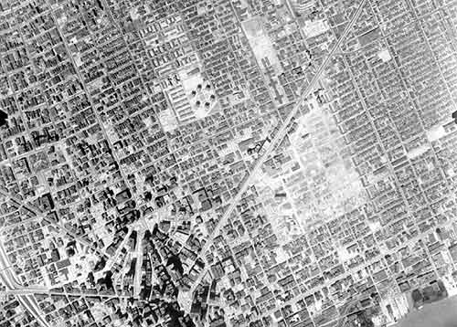
1961: Almost a decade later, you can see a large space south of Gratiot had been cleared to make way for Lafayette Park, a neighborhood of high-rise residential towers.
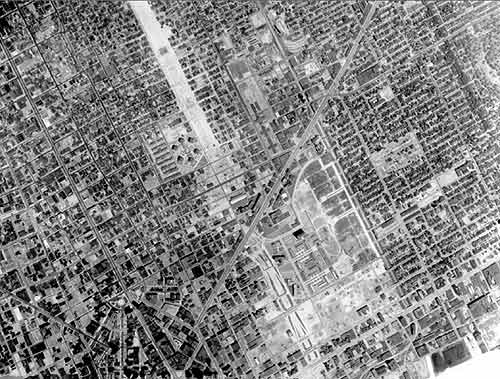
1967: By the mid-1960s, land was cleared and buildings destroyed to make way for Interstate 375.
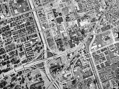
1981: The freeway is complete, along with a monster interchange. The tight network of small streets and small blocks has been replaced by mega blocks.
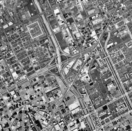
1997: By the turn of the century, the area is almost unrecognizable.
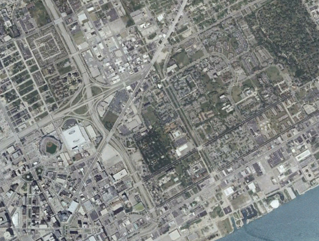
Finally, in this recent shot, you see that the new Tigers Stadium has entered the landscape, surrounded by a field of parking.
Can this process be reversed? Well, the city of Detroit is considering the removal of I-375, so there is hope.
Thanks to user GSGeorge at the forum AtDetroit.net for sharing the first five of these images. The originals up to 1997 -- and other aerial photographs from all over the city -- can be found in this image repository maintained by Wayne State University.
Stay in touch
Sign up for our free newsletter
More from Streetsblog USA
Friday’s Headlines Got Served
Another day, another GOP lawsuit trying to overturn a Biden administration climate change rule.
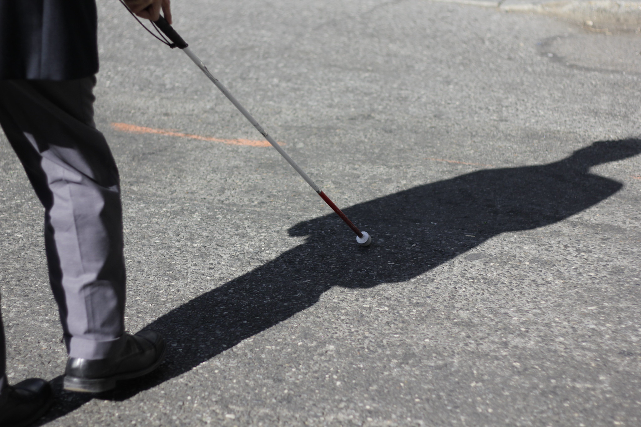
Disabled People Are Dying in America’s Crosswalks — But We’re Not Counting Them
The data on traffic fatalities and injuries doesn’t account for their needs or even count them. Better data would enable better solutions.
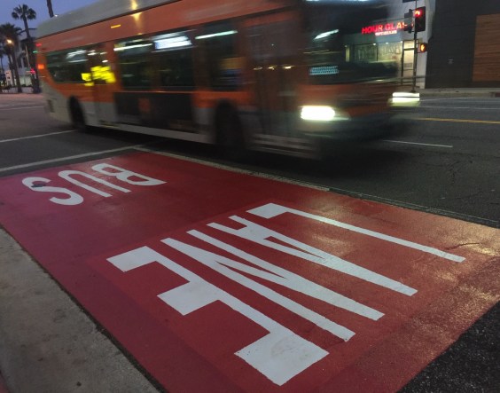
LA: Automated Enforcement Coming Soon to a Bus Lane Near You
Metro is already installing on-bus cameras. Soon comes testing, outreach, then warning tickets. Wilshire/5th/6th and La Brea will be the first bus routes in the bus lane enforcement program.
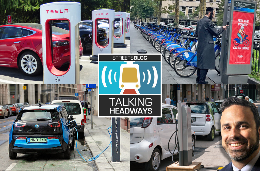
Talking Headways Podcast: Charging Up Transportation
This week, we talk to the great Gabe Klein, executive director of President Biden's Joint Office of Energy and Transportation (and a former Streetsblog board member), about curbside electrification.
Why Does the Vision Zero Movement Stop At the Edge of the Road?
U.S. car crash deaths are nearly 10 percent higher if you count collisions that happen just outside the right of way. So why don't off-road deaths get more air time among advocates?